Previous |
Colin's Munros |
Next |
Route: This route includes two Munros, but can easily be split into
two walks by returning along Gleann Choinneachain from Bealach an Sgairne
after A' Ghlas-bheinn; and by setting off up Gleann Choinneachain towards Bealach an Sgairne
for Beinn Fhada. In the latter case, the path splits about 1km west of the Bealach an Sgairne.
This split is very clear, but higher than is apparent from the 1:25000 map.
(Don't despair thinking you've missed the turn – it's some way up from the burn crossing
after several zig-zags!)
The route includes all the Munro tops of Beinn Fhada.
This requires extra detours out along the SE and NW ridges of Beinn Fhada.
The latter provides the start for a very interesting alternative
to a return via Gleann Choinneachain and is the one given in the GPX file.
Both return choices are described in the table below and are pretty similar
in terms of effort – one shorter but with more ascent.
The descent via Beinn Bhuidhe has some minor, straight-forward scrambling which takes time,
and just one difficulty in wet/winter conditions ascending NW from Bealach an t-Sealgaire.
The highest pinnacle on this ridge, Ceum na h-Aon-choise, is at NG9954920118 and has a height of 924.9m
rather than the 891m marked on the map. Its south top at NG9968419777 has a height of 922.1m.
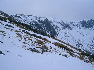
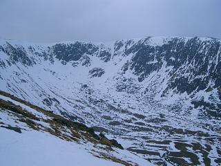
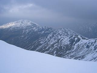
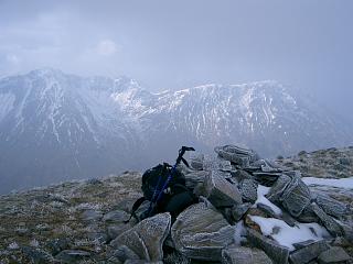
Conditions 15/3/06: 6°C at car; 100% overcast all day; bitter light/moderate E wind. Initially cloud at 800m, rising to 950m. Dry throughout. Snow above 600m, often sinking in up to 6 inches, crampons not really necessary. 25/9/08: Overcast, dry.
| 15/3/06 | 25/9/08 | Description | Ht. | Asc. | Distance | Grid Ref. | Mob. |
| 0635 | 0700 | Park at P on loop of old A87 at Morvich (NT Falls of Glomach car park by Mountain Rescue building.) Initially, follow signs to Falls of Glomach. |
10 | 0 | 0.0 miles | NG96132107 | Orange |
| 0710 | Track E to Bridge over R.Croe | 15 | 5 | 0.5 miles | NG96832108 | ||
| 0710 | 0740 | Path NE to footbridge over Abhainn Chonaig, 125m after taking left fork where valley divides. |
60 | 70 | 1.8 miles | NG98172233 | |
| 0750 | Right onto track, then first sharp left (after gate at forestry road – signed) |
80 | 90 | 2.1 miles | NG98232260 | ||
| Right after 200m (signed for the Falls) | 110 | 120 | 2.2 miles | NG98272279 | |||
| 0755 | Bear right at shallow fork after 200m (signed) | 125 | 135 | 2.33 miles | NG98382296 | ||
| 0735? | 0805 | Cross river & ascend to FtBr at forest exit | 175 | 190 | 2.9 miles | NG98562382 | |
|
Turn sharp right before bridge and follow path ESE up ridge by edge of forest. (Don't take the path towards Glomach Falls which crosses the small bridge and goes up the side of the valley opposite.) |
|||||||
| 0905 -0910 | 0935 -0945 |
ESE/E up easy ridge to M A'Ghlas-bheinn | 918 | 940 | 4.45 miles | NH00822308 | Orange |
| Descend SSE to pt 806 | 806 | 940 | 5.0 miles | NH01022230 | |||
| S to col | 725 | 5.15 miles | NH01132206 | ||||
| 0950 | 1010 | S to top by lochan | 758 | 975 | 5.27 miles | NH01262190 | |
| 1010 -1015 | 1030 | S to large cairn at Bealach an Sgairne | 510 | 5.6 miles | NH01472145 | ||
| 1030 | 1045 | Descend path W down to path split.
(It is easiest to go this way as the path is very good.) |
410 | 6.1 miles | NH00652139 | ||
| 1110 | Ascend path S to lip of upper corrie | 575 | 1140 | 6.75 miles | NH00622050 | ||
| 1120 | 1135 | Ascend path SE to cairn on ridge | 750 | 1315 | 7.05 miles | NH01092028 | |
| 1205 | — | Either: Path SW round corrie rim to T Meall an Fhuarain Mhoir |
954 | 1520 | 8.15 miles | NG99991963 | Orange |
| — | ESE to Plaide Mor | 889 | 8.55 miles | ||||
| 1250 -1300 | — | ESE to M Beinn Fhada trig pt (or by-pass to south) |
1032 | 1665 | 9.35 miles | NH018192 | Orange |
| — | 1210 -1215 |
Or: S/SE/E to M Beinn Fhada trig pt | 1032 | 1600 | 7.9 miles | NH01851926 | Orange |
| Then: Path S/SE to minor top on SE ridge | 1000 | 1685/1620 | 9.75/8.3 miles | NH01971867 | |||
| 1245 | ESE to last (lowest) col | 914 | 1700/1635 | 10.45/9.03 miles | NH03041850 | ||
| 1345 | 1250 -1255 |
E to T Sgurr a'Dubh Doire | 962 | 1750/1685 | 10.75/9.3 miles | NH03471855 | No Orange |
| 1300 | Return W to col | 914 | 11.0/9.57 miles | NH03041850 | |||
| 1320 | WSW then WNW to top | 1000 | 1850/1785 | 11.7/10.3 miles | NH01971867 | ||
| 1430 -1435 | — | Either: NW then N back to Beinn Fhada trig pt | 1032 | 1905 | 12.1 miles | NH01851926 | |
| 1505 | — | Ridge W/NW down to cairn at top of path into corrie. |
750 | 13.0 miles | NH01092028 | ||
| 1550 -1600 | — | Path W into corrie then N to ford of Allt a'Choire Chaoil. |
320 | 14.15 miles | NH00362133 | ||
| 1640 | — | Path W to junction with Glomach Falls path | 75 | 15.7 miles | NG981222 | ||
| — | 1325 | Or: Turn off ridge onto path by-passing summit | 10.5 miles | NH01791894 | |||
| — | 1340 | Path contouring WNW to lochan on Plaide Mor (lochan unmarked on map) |
889 | 11.25 miles | NH00641943 | ||
| — | 1350 -1400 |
W to T Meall an Fhuarain Mhoir | 954 | 1850 | 11.7 miles | NG99991963 | Orange |
| — | 400m WNW to W top | 922.1 | 1880 | 11.95 miles | NG99681978 | ||
| — | 1420 | 350m NW to Ceum na h-Aon-choise (the highest pinnacle) |
924.9 | 1930 | 12.15 miles | NG99552012 | |
| — | 1430 | NW to Bealach an t-Sealgaire.
The only significant scrambling is from here up to next top. |
815 | 1940 | 12.33 miles | NG99312032 | |
| — | 1440 | 125m N to Sgurr a'Choire Ghairbh | 864 | 1990 | 12.43 miles | NG99272048 | |
| — | 1500 -1505 |
500m of slow ridge NNE to N top (at corner of ridge) |
870 | 2075 | 12.75 miles | NG99462089 | |
| — | NNW down to knoll Faradh Nighean Fhearchair | 757 | 2090 | 13.0 miles | NG99352132 | ||
| — | WNW to Beinn Bhuidhe | 502 | 2105 | 13.55 miles | NG98572166 | ||
| — | 1555 | W to corner of deer fence | 195 | 14.1 miles | NG97672144 | ||
| — | 1600 | Through gate in deer fence | |||||
| — | 1610 | Grass track W to Glomach Falls path by cow shed |
15 | 14.6 miles | NG96952127 | ||
| 1615 | Then: Bridge over R. Croe | 15 | 16.95/14.75 miles | NG96832108 | |||
| 1715 | 1625 | Track SW back to NT Car Park | 10 | 1905/2105 | 17.45/15.25 miles | NG96132107 | Orange |
| Previous | Top | Next |