Previous |
Colin's Munros |
Next |
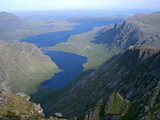
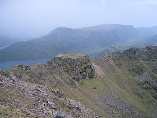
Route: For this route these remote three Munros require
the rather long walk-in of 7 miles each way from Kinlochewe to Loch Fada.
By contrast, all the Fisherfield 5 (formerly 6) with the Munro Tops from
Corrie Hallie via Shenavall is 25 miles and requires 2800m ascent (see
here).
That is nearly twice the ascent of here.
I prefer to do the Fisherfields over two days, rather than carry stuff for staying overnight at Shenavall.
This splits the ascent into two fairly even, reasonable halves, but adds a few miles.
The rest of the Fisherfield 6 (including the re-classified Corbett Beinn a' Chladheimh, if desired)
are described here.
With this split the total ascent for them all is about the same as from Corrie Hallie.
Splitting the group into two sets makes good sense when the two Munro tops of Mullach Corie Mhic Fhearchair
are to be included.
However, I have climbed all 7 Munros and Tops in one expedition from Kinlochewe, bivvying half way round
as described on the next page.
Terrain: There is no path along NE shore of Loch Fada,
but instead time-consuming peat bogs everywhere below 600m.
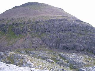
There is a good path from the main top of A'Mhaighdean to Ruadh Stac Mor,
with good cairns marking each end of the ascent through the crags of Ruadh Stac Mor.
(Note that from the bealach another path bends round and down to
Fuar Loch Mor, but the path to Ruadh Stac Mor carries straight on.)
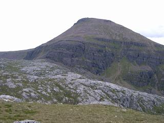
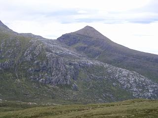
The west ridge of Beinn Tarsuinn is narrow with pinnacles, but straightforward scrambling.
The descent from Beinn Tarsuinn is straightforward but rocky down to 700m,
then peat bogs and a deep ravine for the main burn S down from Bealach Odhar.
Follow the path on the E side of this ravine.
Weather 26/6/04: Gusty winds; sunny till 11.30 then continuous rain
with a thunderstorm.
Weather 2/4/08: Heavy wet snow above 600m, but dry, sunny intervals & light wind.
| 26/6/04 | 2/4/08 | Description | Ht. | Asc. | Distance | Grid Ref. | Mob. |
| 0315 | 0630 | From A832 at E end of Kinlochewe follow sign to Incheril, and park at end of road (a large car park) |
40 | 0 | 0.0 miles | NH0377562395 | Orange |
| 0405 | 0720 | Take track E/NE to fork at Heights of Kinlochewe | 85 | 45 | 2.6 miles | NH0721264186 | |
| 0420 | 0735 | Left fork in track then N to bridge | 145 | 105 | 3.4 miles | NH0740965335 | |
| 0440 | 0755- 0800 |
N to track end at path split | 260 | 220 | 4.3 miles | NH0702766691 | |
| 0505 | 0825 | Left path NW to start of first lochan | 320 | 280 | 5.4 miles | NH06276835 | |
| 0530 | 0855 | Sandbank at E end of Loch Fada | 320 | 290 | 6.85 miles | NH05046992 | |
| 1010 | NW above loch to rocky outcrop at Meallan a' Chruidh (There's no obvious path by the loch shore.) |
500 | 470 | 8.8 miles | NH02917228 | ||
| 1045 | Contour NW round to Pollan na Muice | 525 | 505 | 9.75 miles | NH02007335 | ||
| 0810 | 1200- 1205 |
Ascend ridge NW to M A'Mhaighdean, S top | 967 | 950 | 10.9 miles | NH0077574913 | Orange |
| NE to col | 935 | 11.0 miles | NH00927501 | ||||
| 0820 | 1215 | N to A'Mhaighdean, N top | 948 | 960 | 11.17 miles | NH0096675264 | |
| 0845 | 1240 | Descend SE/E/NE to bealach | 750 | 11.6 miles | NH0164375435 | ||
| 0900 | 1305 -1310 |
Follow winding path NNE up through crags, then E to M Ruadh Stac Mor |
918 | 1130 | 11.9 miles | NH0185275662 | Orange |
| 0930 | 1325 | Return W/SSW down crags to bealach | 745 | 12.15 miles | NH0164375435 | ||
| 1010 | 1420 | Contour S at 750m to Stac a'Chaorruinn then descend S/SE back to Pollan na Muice |
525 | 13.35 miles | NH01707440 NH0211473529 | ||
| 1515 | Ascend E/ENE to NW ridge of B.Tarsuinn | 800 | 1405 | 14.1 miles | NH03347335 | ||
| 1130 | 1555 -1600 |
Scramble S/SE/E over pinnacles to M Beinn Tarsuinn | 937 | 1570 | 15.0 miles | NH0396172792 | No Orange |
| ESE to Bealach Odhar | 730 | 15.45 miles | NH04637258 | ||||
| — | Optional: Detour to Meall Garbh | 851 | 1690 | 15.65 miles | NH04957263 | ||
| 1300 | 1710 | Due S on E side of burn down to sandbank at E end of L. Fada |
320 | 17.3 miles | NH05046992 | ||
| 1330 | 1745 | Return SE along path to S end of first lochan | 320 | 1710 | 18.75 miles | NH06276835 | |
| 1750 | SSE to deer fence (start of excellent path) | 310 | 18.9 miles | NH0630868081 | |||
| 1400 | 1810 | Path SSE to track end (at path split) | 260 | 19.87 miles | NH0702766691 | ||
| 1415 | 1830 | Track S to bridge | 145 | 20.8 miles | NH0740965335 | ||
| 1845 | S to track intersection at Heights of Kinlochewe | 85 | 21.55 miles | NH0721264186 | |||
| 1530 | 1930 | Track SW to car park at Incheril | 40 | 1710 | 24.2 miles | NH0377562395 | Orange |
| Previous | Top | Next |