Previous |
Colin's Munros |
Next |
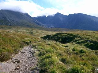
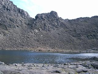
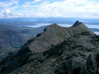
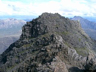
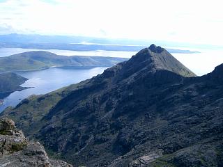
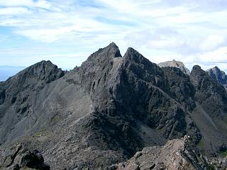
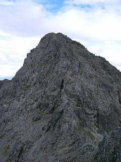
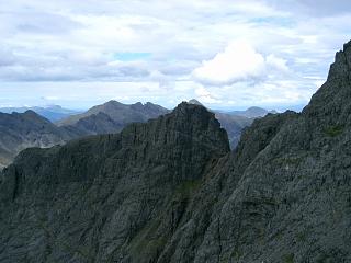
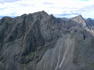
Access: The very useful bus used to reach Glen Brittle no longer runs.
Map: By far the best map to use for the Cuillin is the 1:12500 scale Harvey's Superwalker map,
"Skye: The Cuillin".
The Ordnance Survey 1:25000 map suffers in clarity from too much heavy shading for cliffs.
Route:
There are several route choices to make regarding ascent to and descent from the main ridge.
Some of them illustrated by the two versions below, including comments on some poor choices I made!
The GPX file above gives the best route up Sgurr nan Eag and chooses a descent from
Bealach Coir a' Ghrunnda to Loch Coir a' Ghrunnda. There is an alternative descent from
Bealach Coir a' Ghrunnda west down the Sgumain Stone Shoot to the southern of the two paths crossing Coire Lagan.
Further detail and useful GPX files are given here for a similar walk.
As the ridge is consistently above 800m, it is easily possible to add in Sgurr Sgumain
and/or Sgurr Alasdair to an ascent of Sgurr nan Eag and the “two Dubhs”.
There are sufficiently many different paths to avoid most difficulties.
However, I could see no safe way passed the Mauvais Pas between Sgurr Sgumain
and Sgurr Alasdair and was consequently unable to add both of these summits to the walk
in the time available.
Many of the valley paths are now properly built and maintained.
Currently (May 2017), the upper path below Sron na Ciche is the better constructed.
The times below predate this construction phase when the paths in Coir' a' Ghrunnda were rather slow.
When dry, most ridge paths are easy to follow by observing where the rock face is scratched
by crampons, where the rocks are whiter, and where rocks have been broken into smaller pieces.
In cloud or damp conditions, time can often be wasted looking for a safe route.
As elsewhere in the Cuillins, it is rock underfoot all the way, and so hard on joints.
References in the last column below are to J. Wilson Parker's
"Scrambles
in Skye", Cicerone Press, 1983.
Weather 17/8/04: Excellent.
| 1000 | Bus to P at Glen Brittle Camp Site. | 2 | 0 | 0.0 miles | NG40892065 | |
| 1145 | Upper path ESE under SW flank of Sron na Ciche to Coir' a' Ghrunnda and thence to Loch Coir' a' Ghrunnda. |
697 | 690 | 3.25 miles | NG45052020 | #5 |
| 1205 | Ascend E to col on ridge N of Caisteal a'Garbh-choire, creeping under large boulder on ridge. (It is just as easy and shorter to join the ridge further south.) |
797 | 790 | — | NG45432031 | #5, 3S |
| 1235 | Take path S on E side of Caisteal a'Garbh-choire, then cross to ascend path on W flank of ridge S to M Sgurr nan Eag. Avoid difficulties by keeping west & following scratches on rock. |
924 | 950 | 3.9 miles | NG4570519536 | #23, 2W |
| 1315 -1330 |
Return down NNW ridge to Caisteal a' Garbh-choire, and by-pass it on E side to ridge boulder over path at col N of the Caisteal. |
795 | 965 | 4.45 miles | NG45432031 | #24, 3S |
| 1345 | Easy scramble N to T Sgurr Dubh na Da Bheinn | 938 | 1105 | 4.6 miles | NG4552120462 | #26, 3S |
| 1400 | Take E ridge down to col. Avoid difficulties by keeping to crest or to its right. |
875 | 4.7 miles | NG45672052 | #28, 3S | |
| 1410 -1415 |
Ascend E, skirting difficulties by going further east as necessary zigzagging to M Sgurr Dubh Mor |
944 | 1165 | 4.77 miles | NG4575820547 | #29, 4S |
| Return initially S down face, then W back to col. | 875 | 4.85 miles | NG45672052 | #29, 4S | ||
| 1435 -1440 |
Re-ascend W back to T Sgurr Dubh na Da Bheinn |
938 | 1222 | 4.95 miles | NG4552120462 | #28, 3S |
| Easy descent of NW ridge to Bealach Coir' an Lochan NG454206 |
850 | 4.77 miles | NG45292060 | #27, 3S | ||
| Contour anti-clockwise on path just under cliffs of Sgurr Alasdair, then ascend to the col NE of Sgurr Sgumain |
918 | 1285 | 5.35 miles | NG44952073 | ||
| 1515 | 300 yds SW to T Sgurr Sgumain | 947 | 1315 | 5.45 miles | NG4484620674 | #40, 2W |
| — | NE to Mauvais Pas: too difficult & exposed to ascend without protection. (The usual chimney is lower and much further east.) |
950 | — | — | — | #38, RIV |
| 1540 | Return SW to T Sgurr Sgumain | 947 | 1315 | 5.45 miles | NG4484620674 | #40, 2W |
| S for 200 yds to Bealach Coir' a' Ghrunnda | 841 | 5.55 miles | NG44822049 | #39 | ||
| 1610 | Easy descent SE to Loch Coir' a' Ghrunnda, latterly beside stream to its NW corner. |
700 | 5.75 miles | NG45092032 | #7, 2W | |
| 1710 | Descend path SSW to corner where it turns WNW. | 330 | 1340 | 6.55 miles | NG44531928 | #5 |
| 1745 | WNW to path split at ford above camp site | 140 | 8.3 miles | NG42052035 | #4 | |
| 1805 | W to parking at Glen Brittle Camp Site | 2 | 1340 | 9.05 miles | NG40892065 |
Weather 4/11/08: Dry. 8°C at car. Mist down on all tops & ridges. So time spent searching for route in mist on NW ridge of Sgurr Dubh na Da Bheinn.
| 0750 | P at Glen Brittle Camp Site. | 2 | 0 | 0.0 miles | NG40892065 | No Orange |
| 0810 | Head E on path to path split at ford | 140 | 140 | 0.75 miles | NG42052035 | |
| 0830 | Follow left path E passed Loch an Fhir-bhallaich | 170 | 170 | 1.45 miles | NG43092055 | |
| 0835 | Bear right at path split after lochan | 320 | 320 | 1.6 miles | NG43372062 | |
| Path E to cliff below The Cioch | 500 | 500 | 2.2 miles | NG44272037 | ||
| 0950 | E up gully (Sgumain Stone Chute) to Bealach Coir a' Ghrunnda – some very large boulders & scree; mostly straightforward. |
841 | 840 | 2.55 miles | NG44822049 | |
| 1010 -1035 |
Ridge N to T Sgurr Sgumain | 947 | 945 | 2.67 miles | NG4484620674 | Orange |
| 1040 | Head N down from col 10m E of top; then contour 300m E to col with Sgurr Alasdair |
918 | 2.75 miles | NG44952073 | ||
| Descend SE then contour clockwise on path under cliffs of Sgurr Alasdair E to Bealach Coir' an Lochan. Path is unclear below TD gap, so wasted time in mist. |
855 | 3.0 miles | NG45292060 | |||
| 1120 | Easy ridge SE up to T Sgurr Dubh na Da Bheinn | 938 | 1030 | 3.15 miles | NG4552120462 | Orange |
| Path E down crest of ridge to col. (I used the left flank of the ridge and had problems.) |
875 | 3.25 miles | NG45672052 | |||
| 1205 | Ascend E skirting difficulties by taking path to right as necessary to M Sgurr Dubh Mor |
944 | 1085 | 3.33 miles | NG4575820547 | Orange |
| 1220 | Return SW down face, then W back to col | 875 | 3.4 miles | NG45672052 | ||
| 1235 | W to T Sgurr Dubh na Da Bheinn | 938 | 1140 | 3.5 miles | NG4552120462 | Orange |
| 1305 | SW/S to ridge boulder N of Caisteal | 803 | 3.65 miles | NG45432031 | ||
| 1310 | Path S on E side of Caisteal a'Garbh-choire to Bealach a'Garbh-choire |
795 | 3.75 miles | NG45432018 | ||
| 1335 | S on W flank of ridge to NW end of summit ridge | 900 | 1250 | 3.95 miles | NG45481986 | |
| 1345 -1355 |
SE to M Sgurr nan Eag | 924 | 1270 | 4.2 miles | NG4570519536 | Orange |
| 1520 -1535 |
Descend SW flank of hill (nasty scree) direct to valley path at Allt Coir' a' Ghrunnda (It is pleasanter to return via L. Coir' a' Ghrunnda) |
340 | 5.0 miles | NG44771935 | ||
| 1605 | Path NW to Allt Coire Lagan | 210 | 6.1 miles | NG43211989 | ||
| 1625 | Path WNW to join path from Coire Lagan | 140 | 6.85 miles | NG42052035 | ||
| 1645 | Path W to P at Glen Brittle Camp Site | 2 | 1270 | 7.65 miles | NG40892065 | No Orange |
| Previous | Top | Next |