Previous |
Colin's Munros |
Next |
Evaluation: 4 star.
Route: This strange collection of hills remained after I had bagged
Seana Bhraigh on a previous occasion.
However, it makes sense for the scenery on the east side of Beinn Dearg.
It includes fine views into Choire Ghranda from the south ridge of Beinn Dearg,
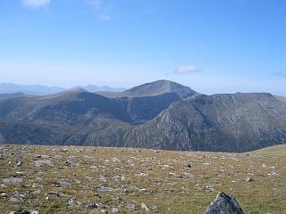
a very pleasant visit to Loch Prille, and views of the magnificent cliffs
above Loch a' Choire Ghranda from Am Faochagach.
There is a useful stretch of stalkers' path shown on the 1:25000 OS map
west of Loch a' Gharbhrain.
If the Allt a' Gharbhrain is in spate, continue NW to about 440m (NH25387887)
and ascend Beinn Dearg via the Allt Beinn Dearg. If the Abhainn a'Gharbhrain
is in spate, cross it safely 150m S from Loch a'Gharbhrain by a reed bed,
NH2818075557 (GPS). Here the river bed pebbles are much smaller and not slippery,
the river is much wider and of a more consistent depth, and there are no
concentrations of flow at any point, making it a safe point to cross.
Even after prolonged heavy rain, I have waded across without any problem
with water at most knee deep but, of course, wet feet are the result.
Sticks useful for descending the first steep 100m from Cona' Mheall
and for fording the Allt a' Gharbhrain and the Abhainn a' Gharbhrain.
The main downsides to this walk are the very boggy path between the road
and the Abhainn a' Gharbhrain, and fording that river.
| 0825 | Park by former weather station on A835 at NW end of Loch Glascarnoch NH277744 |
270 | 0 | 0.0 miles | NH27657428 |
| From opposite side of A835, take very boggy path NW/N towards L. a' Gharbhrain. Continue up W side of the loch then by Allt a' Gharbhrain to stream from right. |
380 | 110 | 2.6 miles | NH26437787 | |
| Ascend burn NE towards L. nan Eilean, then NNW up ridge to plateau. |
805 | 535 | 3.67 miles | NH26357942 | |
| Skirt pt 885 on left | 885 | 615 | 4.05 miles | NH26707996 | |
| 1030 | N to col | 825 | 4.25 miles | NH26598027 | |
| 1110 | N/NW/W up nice ridge to M Beinn Dearg | 1084 | 875 | 5.05 miles | NH25948120 |
| 1140 | Go due N from summit cairn to intersect path down at dike. Descend NE by path on NW side of dike to lochan on bealach |
855 | 5.5 miles | NH26328182 | |
| 1145 | Take path contouring round S of 886m lump E to bealach |
815 | 875 | 5.85 miles | NH26888178 |
| 1205 | Path ESE up to M Cona' Mheall (980) | 978 | 1040 | 6.25 miles | NH27498166 |
| 1310 | NNE to corner of plateau, then steep descent E down cliffs to Loch Prille. (It may be easier leaving summit ridge 100m S of summit) |
545 | 7.13 miles | NH28788156 | |
| 1410 | Straightforward ford of loch exit stream then ascend SE/S to Meallan Ban (large cairn) |
882 | 1380 | 8.37 miles | NH29838009 |
| 1425 | Continue SSE up to M Am Faochagach (boring except for view) |
954 | 1475 | 8.9 miles | NH30367939 |
| 1445 | Descend SW/S to cairn | 845 | 1500 | 9.8 miles | NH29987807 |
| Continue SW to col | 710 | 10.9 miles | NH30367701 | ||
| 1545 | Descend path to the river ford at NH28137531 or veer over to L. a'Gharbhrain and ford its outflow. The latter is safer, flat, shallow and easy. |
275 | 12.1 miles | NH28187554 | |
| 1605 | Boggy path S to car park on A835 at bridge. | 270 | 1505 | 13.05 miles | NH27657428 |
| Previous | Top | Next |