Sgurr nan Eag, the two Dubhs, Sgurr Alasdair & Sgurr Thearlaich; 16th May 2005
Route:
1380m = 4530' ascent; 8.3 miles.
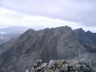
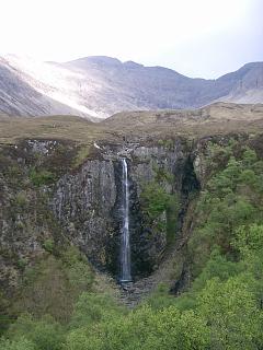
Map: By far the best map to use for the Cuillin is the 1:12500 scale Harvey's Superwalker map,
"Skye: The Cuillin".
The Ordnance Survey 1:25000 map suffers in clarity from too much heavy shading for cliffs.
Access: Park either at the Memorial Hut or, preferably,
at the road end parking just before the camp site in Glen Brittle.
Route:
This was a guided walk over Sgurr nan Eag, Sgurr Dubh Mor, Sgurr Dubh na Da Bheinn and Sgurr Alasdair.
A couple of Munro Tops can be added easily if desired: Sgurr Thearlaich and Sgurr Sgumain.
Starting with Sgurr nan Eag, the route traverses below Sgurr Dubh na Da Bheinn over to Sgurr Dubh Mor,
then back over Sgurr Dubh na Da Bheinn before descending NW to Bealach Coir' an Lochain.
A traverse is then made immediately under the cliffs on the south face of Sgurr Alasdair
and so, by ascending a chimney on the far side of the cliffs, the summit of Sgurr Alasdair is attained.
Before descending the stone chute into Coire Lagan and back to Glen Brittle,
a short optional detour up Sgurr Thearlaich is included.
Details and Issues:
On the way to Loch Coir' a Ghrunnda take the upper path round Sron na Ciche.
There is a spot of scrambling once above a height of 550m. The path is not always clear,
but any extended or hard scrambling indicates loss of the correct route.
The path continues up from the SE shore of Loch Coir' a Ghrunnda,
meeting the path from Bealach a' Garbh-choire below the ridge at about 850m.
The path then heads up to the ridge and bypasses a number of rocks and pinnacles
on the right (SW) side before reaching the summit of Sgurr nan Eag.
On the descent, the point of departure from the ridge is clear.
Soon thereafter the path splits into one which goes back down to Loch Coir a'Ghrunnda
and another which continues on to Bealach a' Garbh-choire and
re-gains the crest of the ridge after a short horizontal section.
This path splitting is easy to spot as long as the cloud is up,
you keep an eye out for it and the rock is dry.
In other circumstances, the splitting point can be very difficult to determine
as there are multiple tracks among the rocks.
From the southern branch of Bealach a' Garbh-choire the easiest path goes round
the east side of Caisteal a' Garbh-choire to the northern branch of the bealach.
Although the guide then by-passed Sgurr Dubh na Da Bheinn and contoured round to the col
west of Sgurr Dubh Mor, the route is not obvious and it is safer to
follow the path up Sgurr Dubh na Da Bheinn which ascends just west of the crest of its S ridge.
The path from Sgurr Dubh na Da Bheinn to Sgurr Dubh Mor follows the crest down to the col
and then snakes up the S face of the Munro avoiding pinnacles on the crest of the ridge.
On returning to Sgurr Dubh na Da Bheinn, take the path down the NW ridge to Bealach Coire an Lochain.
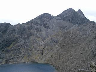
For the ascent of Sgurr Alasdair, see the (second) photo above of Sgurr Alasdair
above Loch Coir a'Ghrunnda. Click the thumb nail for the full size image.
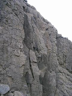
Follow the path below the cliffs of Sgurr Alasdair from right to left (east to west)
until the cliffs terminate at the end of a short wall below Bealach Sgumain.
Take a sharp right and follow a path along the scree above the wall
to a chimney. This is the crux of the ascent, but is easy.
It is then a short, steep climb to the summit with no difficulties.
Avoid going up as far as Bealach Sgumain because of the "Bad Step"
which is encountered almost immediately on the ridge to Sgurr Alasdair.
From the summit of Sgurr Alasdair it is only a few easy yards down to the col
at the head of the Great Stone Chute. From there, an ascent of
Sgurr Thearlaich starts with a 12' pitch directly from the col. It is fairly straightforward,
and there is no difficulty thereafter, except that the pitch must be found on the return
(not so easy) and its descent is a bit tricky as the footholds cannot be seen.
However, if necessary there is an easier route starting further south from the col.
To complete the walk, descend the stone chute to Loch Coire Lagan and take the path
west back to the starting point.
There are one or two route finding problems on the path
below the cliffs on the west side of Coir' a' Ghrunnda,
partly caused by the existence of several paths to choose from
(some going in the right direction, others going elsewhere, and even some going nowhere),
and partly because the path sometimes disappears.
Some useful GPS grid references as a guide are in the gpx file
CoirGhrunnda.gpx.
On the ascent, it is easy to be seduced into taking a path that goes too far to the right
up Sron na Ciche. If used for a descent, the gullies and ledges which the path takes through
the bands of cliffs are not easy to spot.
For the path up Sgurr nan Eag from the lochan, use the file
SgurrNanEag.gpx.
For an ascent in mist, the starting point at the lochan is well worth knowing.
For the traverse between the two Dubhs, use the gpx file
DubhsTraverse.gpx.
Route finding for the ascent of Sgurr Dubh Mor is problematic even in good weather
as there are many different paths which scramblers have tried but lead nowhere.
All go up the south face of the peak.
Several zigzags are involved after an initial horizontal traverse from the col.
The gpx file goes to the usual top with the cairn. However, the true summit is
believed to be on the eastern-most pinnacle at NG4575820547 (see
hill-bagging.co.uk).
This way point is included in the GPX file with link at the top of the page.
The three GPX files with links in these paragraphs represent the paths as of May 2017.