Previous |
Colin's Munros |
Next |
Route 15/7/05:
This route is via the Basteir Gorge. Another route is given below.
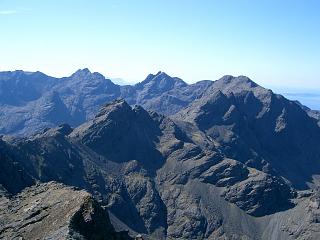
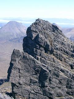
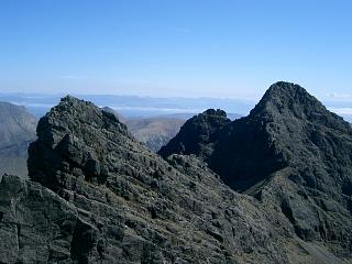
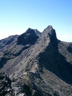
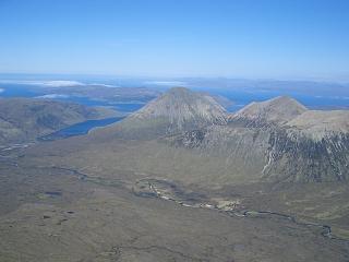
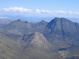
The photos include some indication of where the paths go where scrambling is required.
As always, note that my grid references (and heights) are mostly taken from the map
and therefore are not entirely accurate.
I've highlighted the main difficulties below.
Am Basteir:
The path goes up the west side side of the Allt Dearg Beag, above the gorge.
There is a good path south up the screes of Coire a' Bhasteir –
it should be easy to find in thick mist. From under the cliffs of Am Basteir,
it branches left to Bealach a Bhasteir and right to Bealach nan Lice.
From the latter, there is an easy path over to the trig point on Bruach na Frithe,
but, for Am Basteir, take the left branch to Bealach a Bhasteir and then west up the ridge.
Am Basteir has only one awkward point, which is a gap about half way up.
This “bad step” is not difficult when returning eastwards as long as your are 6' or taller,
but is a pain when going westwards. It is best avoided on ascent
by taking to the south slopes, about 20m or so down to the left,
but that has a few difficulties itself unless you know the route well.
The Tooth is for experienced scramblers only, requiring a 10' abseil down an overhang
just after leaving the summit of Am Basteir. A rope can be left in place for the return.
Sgurr a'Fionn Choire has relatively easy scrambling access up its NNW face
via one of two gullies. The west ridge is possible, although more demanding of skill.
It provides spectacular views of the Basteir Tooth and so should certainly not be missed.
Sgurr nan Gillean: Sgurr nan Gillean is done by turning left from Bealach a Bhasteir,
the sole difficulty being the ascent of one of the three neighbouring chimneys on the ridge.
These involve straight forward easy scrambling.
Knight's Peak was measured carefully in 2013 and found to be 6" under 3000 feet.
Nevertheless, it is a great top to visit. The easiest route from Sgurr nan Gillean starts by
descending about 200m of the west ridge of Sgurr nan Gillean (not the expected north ridge)
and then taking a path horizontally NE over to the north ridge.
Good visibility is required for this. There is a tricky, exposed final descent over slabs
and a pinnacle to get round to reach the col with Knight's Peak,
but once on the col the ascent is an easy scramble zigzagging up ramps.
In case of difficulty, retreat to the top of Sgurr nan Gillean and return by the tourist route
which is initially down the SE ridge.
| 0950 | Sligachan | 13 | 0 | 0.0 miles | NG48452978 |
| Loch a'Bhasteir | 595 | 580 | 2.9 miles | NG46882578 | |
| 1220 | Bealach a' Bhasteir | 833 | 820 | 3.3 miles | NG46862529 |
| 1300 | M Sgurr nan Gillean | 965 | 950 | 3.5 miles | NG4716125301 |
| 1325 | Bealach a' Bhasteir | 833 | 3.7 miles | NG46862529 | |
| 1350 | M Am Basteir | 935 | 1050 | 3.85 miles | NG4656325301 |
| 1400 | T Basteir Tooth | 915 | 1110 | 3.9 miles | NG4650825279 |
| M Am Basteir | 935 | 1185 | 3.95 miles | NG4656325301 | |
| Bealach a' Bhasteir | 833 | 4.1 miles | NG46862529 | ||
| Bealach nan Lice | 896 | 1300 | 4.4 miles | NG46472528 | |
| 1500 | M Bruach na Frithe | 958 | 1365 | 4.65 miles | NG4608425201 |
| Bealach nan Lice | 896 | 4.9 miles | NG46472528 | ||
| 1540 | Loch a'Bhasteir | 595 | 5.3 miles | NG46882578 | |
| 1640 | Sligachan | 13 | 1370 | 8.2 miles | NG48452978 |
Route 3/5/07:
This is the better of the two walks, and provides alternatives for the ascent to and descent from the ridge.
The route is reasonably straightforward & can be done safely by competent climbers without any ropes
except for the short abseil on Am Basteir when descending to the Tooth.
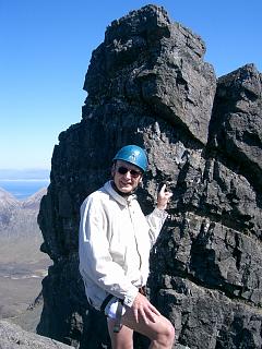
Helmets are essential, of course, as climbers above can easily dislodge stones.
The main problems are:
i) The bad step on Am Basteir, for which there is no real problem
in either direction if you are 6' tall. Otherwise a detour on the S side is required.
Such a detour can be slippery when the rock is wet.
ii) The 3m abseil just below the summit of Am Basteir en route to Tooth:
This requires rope to abseil down and some effort jumping back up if no rope is in place.
There are high footholds above the small overhang, but it is then difficult to
reach the handholds to pull oneself up. Try standing on your partner's
knee or shoulder, and then throw down a rope to him.
iii) There are several routes from Am Basteir to the Tooth.
Going down the ridge crest as far as possible avoids messy ropework on the south face.
iv) The chimneys on Sgurr nan Gillean's west ridge are a little exposed.
v) The last few metres of descent from Sgurr nan Gillean to the pinnacle in the
col with Knight's Peak (KP) are somewhat exposed.
vi) The climb up from KP to the 3rd pinnacle, normally abseiled in other direction:
Half way up the chimney below the abseil point, turn to the right and ascend
beside an obvious grove. There is an initial exposed move, which is much
easier & safer on the rock 1 foot to the right of the grove rather than in it.
I used a number 11 chock (1" wide) for protection here.
The upper part above this move is perfectly easy, but it cannot be seen from below.
The second last column in the route table below gives the route numbers and climbing grades from Parker's
"Scrambles in Skye".
Time: It was far too hot for any speed, and times were further delayed by
inexperience at rope work.
Weather: A perfect day except for the great heat.
| 0900 | Car Park & path end at head of Glen Brittle | 90 | 0 | 0.0 miles | NG42362581 | ||
| 0945 | ENE beside forestry to Bealach a'Mhaim – cairn beside a lochan. |
344 | 265 | 1.7 miles | NG44782690 | 1 1W | |
| SE up ridge to highest running water | 600 | 520 | 2.4 miles | NG45452606 | 77 1W | ||
| 1110 -1120 |
Continue to narrowing of ridge, then horizontal on path for several hundred yards. Path ascends slowly well below ridge before following a dike to M Bruach na Frithe trig pt |
958 | 880 | 3.05 miles | NG4608425201 | 77 3S | Orange |
| E to col | 900 | 3.2 miles | NG46312525 | 76 2W | |||
| 1135 | E up ridge (see above) to T Sgurr a'Fionn Choire | 935 | 915 | 3.3 miles | NG4642925207 | 78 4S | |
| N to Bealach nan Lice | 896 | 3.3 miles | NG46472528 | 78 4S | |||
| 1210 | ENE below Am Basteir to Bealach a' Bhasteir | 833 | 967 | 3.6 miles | NG46862529 | 15 2W | |
| 1230 | Ascend W over bad step to M Am Basteir | 934 | 1070 | 3.8 miles | NG4656325301 | 84 RII | Orange |
| Descend W to col (the Nick) after 3m abseil near top. Leave rope in place for help on return. |
~885 | ~NG46552528 | 85 RIII | ||||
| 1320 | Easy ascent NW to T Bhasteir Tooth | 916 | 1100 | 3.85 miles | NG4650825279 | 85 4S | |
| SE back to the col (the Nick) | ~885 | ~NG46552528 | 85 4S | ||||
| 1345 | E back up to M Am Basteir, using abseil rope as an aid near top. |
934 | 1150 | 3.9 miles | NG4656325301 | 85 RIII | |
| 1355 | Descend E ridge to Bealach a' Bhasteir | 833 | 4.05 miles | NG46862529 | 84 RII | ||
| 1455 | Scramble E up west ridge to M Sgurr nan Gillean (There are three chimneys to choose from.) |
964 | 1280 | 4.25 miles | NG4716125301 | 87 RII | Orange |
| Return down W ridge for 200m then take path NE across the N face to Pinnacle Ridge. Descend to col (exposed down to a small pinnacle, then tricky going round N side of it) then ascend straightforward ledges to X Knight's Peak |
914 | 1330 | 4.4 miles | NG4718025426 | 88 RIII | ||
| 1710 | Continue to the next (3rd) pinnacle. Its ascent poses the hardest part of the day's climbing – see above. Then continue down Pinnacle Ridge to top of 1st pinnacle |
765 | 1360 | 88 RIII | |||
| 1745 | N to base of 1st pinnacle (end of climbing/scrambling) | 585 | 4.8 miles | NG47232590 | |||
| 1830 | Jog N cross country to path & then N over well-engineered path to Sligachan Hotel |
13 | 1360 | 7.6 miles | NG48452978 |
| Previous | Top | Next |