Previous |
Colin's Munros |
Next |
Access:
In Feshiebridge, take the minor road S into Glen Feshie
which leaves the B970 at the north end of the bridge over the R. Feshie.
Park after about 4.5 miles, at the last car park before the gate into Achlean.
Route: On approaching Auchlean, take a left fork onto the new track which skirts
the farm on the east. The Google aerial view shows this clearly. After a few hundred yards,
the track becomes a constructed path on the right to the Allt Fhearnagan,
which crossing is likely to give you wet feet.
This new path meets the burn at the forest edge and then hugs the forest rather
than following the river bank as shown on the map.
The other significant river on the route is the Allt Garbhlach,
which may also be tricky when in spate.
If necessary, it can be avoided by crossing to other side of R. Feshie
a little after the Allt Fhearnagan,
crossing back at Carnachuin, and following the track all the way up Coire Caol.
The R. Feshie footbridge 0.4 miles S of Achleum was rebuilt around 2006
and was in excellent condition on my visits to it (see
here).
Rather than stick to the path and take the track up Coire Caol,
I prefer a steeper, pathless ascent SE direct to Meall nan Sleac through heather
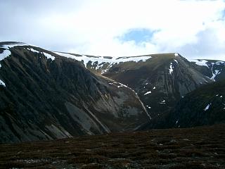
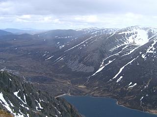
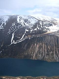
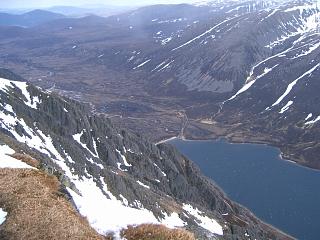
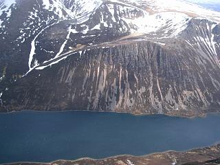
as it is much shorter and more scenic with its views into Coire Garbhlach.
The Allt Garbhlach can be forded higher up just as easily as beside the R. Feshie.
The route on 22/7/08 had slightly different start and finish points from the usual
ends near Achleum, but gained no advantage.
Although there is an excellent tarmacked road up the west side of
Glen Feshie from Insh, there is a padlocked gate at Tolvah, NN842994.
Weather 26/4/06: 2/3rds cloud cover, with a sharp, stiff breeze.
A few short showers – which
meant hail on the tops. 10°C at car.
Terrain: Soft, easy walking over the "great moss".
Small stones, peat, moss and fine granite gravel on the tops, constructed tracks elsewhere.
Grumble about Paths: Note that Cairngorms National Park is ruining the old pathways by
making them all rocky and speed-bumped with excessive numbers of very proud granite culverts.
This spoils any hope of a comfortable, natural walking rythmn, and hurts feet and joints unnecessarily.
The older paths had a much higher ratio of gravel, which was properly bound together with clay,
and wooden culverts were sunk into the path.
Walking was a great pleasure on these. One could look at the scenery while walking along and
didn't have to concentrate all the time on where to put one's feet.
The paths used to be restful, now they tire the mind as well as the body.
People will, and do, vote with their feet: they are walking off the path where possible.
That defeats the sole objective of the path building, namely to preserve the environment.
What's the point of all these big stones sticking up? Obviously to stop
the mountain bikers – but they are far too rare to be a problem.
Perhaps one day the Park will take note and restore more walker-friendly paths once again.
It must be a nightmare for the disabled with the decrease in negotiable paths.
I could also mention ATVs here and the proliferation of tracks for them all over the Cairngorms.
They are clearly by far the biggest erosion threat.
| 26/4/06 | 22/7/08 | Description | Ht. | Asc. | Dist. | Grid Ref. | Mob. |
| 0900 | — | Park in Glen Feshie 1km N of Achlean |
320 | 0 | 0.0 miles | NN85099844 | Orange |
| 0925 | — | Path S passed Achlean to Allt Fhearnagan. | 330 | 10 | 0.8 miles | NN85049721 | |
| 1050 | Path S to FtBr over R. Feshie. (Don't cross it) | 325 | 15 | 1.3 miles | NN85089646 | ||
| Path S by R. Feshie almost to Allt Garbhlach | 350 | 30 | 1.7 miles | NN85079588 | |||
| 1000 -1005 | 1115 | Path ESE up N side of Allt Garbhlach to ford at about 415m |
415 | 105 | 2.35 miles | NN86049540 | |
| 1050 -1055 | 1205 | Ascend ridge (no path) SE to Meall nan Sleac (views) |
800 | 490 | 3.1 miles | NN86829445 | |
| Path E to track at col | 750 | 3.4 miles | NN87299433 | ||||
| 1135 | 1240 | Track SE above Allt Coire Caol to fork. | 970 | 705 | 4.2 miles | NN88319358 | |
| 1150 | 1255 -1300 |
Track S to small cairn at path end just after bend then path S to M Mullach Clach a'Bhlair |
1019 | 760 | 4.85 miles | NN88319270 | Orange |
| N back to track, then N/NE passed Coire Caol turn-off to pt 953. Alternatively, hug the corrie rim for better views. |
953 | 785 | 6.3 miles | NN89249441 | |||
| 1345 | Head NNW off track to stream crossing | 910 | 6.7 miles | NN89009494 | |||
| 1250 | 1400 -1405 |
NW/W to T Meall Dubhag | 998 | 870 | 7.5 miles | NN88059559 | Orange |
| E/NE to col | 966 | 8.0 miles | NN88869595 | ||||
| 1315 | NNE to minor top | 1029 | 930 | 8.45 miles | NN89129659 | ||
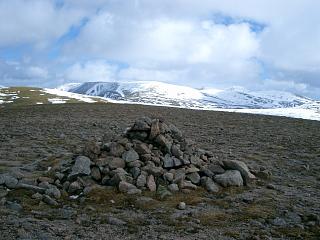
| 1320 | 1425 | NNE to large roofed shelter cairn with grass on top | 8.55 miles | ? | |||
| 1325 | 1430 | NNE to cairn at path crossing | 1030 | 8.65 miles | NN89289686 | ||
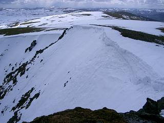
| 1330 | 1435 | NNE to T Carn Ban Mor (26/4/06: Slow snow over all ridge from here to Sgor Gaoith) |
1052 | 955 | 8.9 miles | NN89389719 | Orange |
| NNE to col | 1012 | 9.3 miles | NN89699784 | ||||
| 1410 | 1505 | NNE to M Sgor Gaoith – no shelter | 1118 | 1065 | 10.1 miles | NN90289895 | Orange |
| N to col | 1053 | 10.65 miles | NN90379982 | ||||
| 1435 -1445 | 1535 | N to T Sgoran Dubh Mor | 1111 | 1120 | 10.9 miles | NH90490026 | Orange |
| SW to pt 978 on NW ridge | 978 | 1135 | 11.45 miles | NN89749988 | |||
| WNW down ridge to col | 940 | 11.65 miles | NN89459997 | ||||
| 1515 | 1605 -1610 |
NW to T Meall Buidhe – stoney | 976 | 1170 | 11.9 miles | NH89160019 | Orange |
| NNW to col & cairn | 892 | 12.2 miles | NH88860063 | ||||
| N to minor top | 904 | 1180 | 12.35 miles | NH88780087 | |||
| WNW to col & cairn | 866 | 12.5 miles | NH88600099 | ||||
| 1540 -1545 | 1630 | NNW to T Geal-charn – stoney | 920 | 1235 | 12.8 miles | NH88410143 | Orange |
| 1620 | 1700 | Descend WSW (easy-ish) to path where it crosses Allt nam Bo |
460 | 13.7 miles | NH86990098 | ||
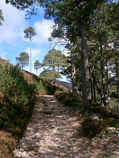
| 1640 | 1715 | Very pleasant path W down through natural Scots pine forestry to forest boundary at cross roads. (At junction with track from bridge over Allt Ruadh.) |
325 | 14.45 miles | NH85860113 | ||
| 1650 | 1725 | Track W into forest as far as road | 285 | 1235 | 14.87 miles | NH85200127 | |
| 1725 | — | S to car park near Auchlean | 320 | 1275 | 16.75 miles | NN85099844 | Orange |
| Previous | Top | Next |