Previous |
Colin's Munros |
Next |
Route:
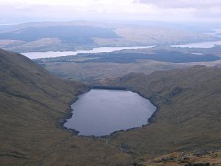
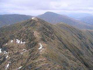
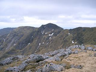
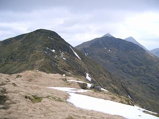
This is a longish route which includes all the Munro tops and the Corbett in the Cruachan massif.
The trip out to Stob Dearg (Taynuilt Peak) is particularly enjoyable
as is the ridge from it over to Ben Cruachan. The Corbett, Beinn a'Bhuiridh, is entirely optional.
It requires only another 170m of ascent but saves a lot of climbing later
if you ever decide to work your way through the Corbetts as well as the Munros.
The route is mostly easy to find. However, note:
| 14/05/06 | 3/10/10 | 14/10/13 | Route Point | Ht. | Asc. | Distance | Grid Ref. | Signal |
| 0905 | 0840 | 1540 | Park on A85 at Falls of Cruachan station. | 40 | 0 | 0.0 miles | NN08022673 | No Orange |
| 0930 | 0905 | 1520 | Ascend path N via low bridge under railway & up E side of Allt Cruachan to stile |
250 | 210 | 0.4 miles | NN08142730 | |
| 0920 | 1510 | Path N to track at bridge | 320 | 280 | 0.7 miles | NN08122774 | ||
| 0950 | 0930 | 1500 | Track/steps N to top of Dam | 400 | 360 | 1.1 miles | NN07872822 | |
| 0955 | 0935 | 1455 | Track 400m N along W shore of Cruachan Reservoir to first tunnel exit. |
400 | 1.3 miles | NN07832849 | ||
| — | EITHER (14/05/06): (shorter and better) Ascend grassy slopes W to SE ridge of Meall Cuanail. |
675 | 635 | 1.7 miles | NN07192884 | |||
| 1045 | — | 1420 | N/NW to T Meall Cuanail. | 918 | 880 | 2.3 miles | NN06942956 | |
| — | 0950 | — | OR (3/10/10): (longer & less pleasant) Track to path end almost at next tunnel |
420 | 380 | – | NN08252943 | |
| — | 1045 -1055 |
— | Path WNW to Bealach an Lochain | 825 | 785 | – | NN06952982 | |
| — | 1105 -1110 |
— | S to T Meall Cuanail. | 918 | 875 | – | NN06942956 | |
| 1055 | 1120 | 1410 | THEN Path N to Bealach an Lochain. | 825 | 875 | 2.45 miles | NN06952982 | |
| 1120 | — | 1345 | EITHER (14/05/06): (tricky, but less effort) Traverse NW over Coire a'Bhachaill directly to col W of Ben Cruachan. (This traverse is unwise except in good visibility; Head first for lower end of obvious ravine, then directly for col, thereby avoiding the worst slabs.) |
1005 | 1055 | 3.0 miles | NN06463055 | |
| — | 1205 -1210 |
— | OR (3/10/10): (more ascent, but easier) Ridge N to M Ben Cruachan (trig pt) |
1126 | 1175 | – | NN06973047 | Orange |
| — | 1230 | — | W to col with Stob Dearg | 1005 | – | NN06463055 | ||
| 1130 -1135 |
1240 -1245 |
1330 -1335 |
THEN: NW to T Stob Dearg. | 1104 | 1155 | 3.2 miles | NN06253075 | Orange |
| 1145 | 1255 | 1320 | SE back to col. | 1005 | 3.4 miles | NN06463055 | ||
| 1205 -1210 |
1315 -1320 |
1245 -1300 |
Technically scrambling E up ridge to M Ben Cruachan, trig pt. (The trig post is broken; only the base remains.) |
1126 | 1280 | 3.7 miles | NN06973047 | Orange |
| Minor scrambling NE to plateau end | 1075 | 3.8 miles | NN07123054 | |||||
| 1230 | E to col | 935 | 4.2 miles | NN07703037 | ||||
| 1400 | 1210 | Minor top | 950 | 1305 | 4.3 miles | NN07883042 | ||
| Cairn on ridge, marking detour N off ridge to Top | 1002 | 4.68 miles | NN08333073 | |||||
| 1250 -1255 |
1420 -1425 |
1145 -1150 |
NE to T Drochaid Ghlas (Note that this top is off the main ridge.) |
1009 | 1380 | 4.7 miles | NN0833130770 | Orange sometimes |
| Return 25m S to cairn marking onward descent path. | 1002 | 4.73 miles | NN08333073 | |||||
| SE to ridge bend | 900 | 4.9 miles | NN08543061 | |||||
| ENE to minor bump | 905 | 1390 | 5.0 miles | NN08703065 | ||||
| 1315 | 1450 | 1125 | ENE to col (on map fold). | 860 | 5.15 miles | NN08963072 | ||
| 1330 | 1510 -1515 |
1105 -1110 |
ENE to M Stob Diamh. | 998 | 1530 | 5.5 miles | NN09483085 | Orange |
| 1525 | 1055 | ENE off main ridge to col. | 910 | 5.65 miles | NN09713098 | |||
| 1345 | 1530 -1535 |
1050 | ENE to T Sron An Isean. | 966 | 1585 | 5.82 miles | NN09933114 | Orange |
| 1540 | 1045 | Return WSW to col | 910 | 6.0 miles | NN09713098 | |||
| 1355 -1405 |
1550 | 1040 | WSW back to M Stob Diamh on main ridge | 998 | 1670 | 6.15 miles | NN09483085 | Orange |
| 1030 | S to col | 930 | 6.4 miles | NN09513044 | ||||
| 1415 -1420 |
1605 | 1025 | S to T Stob Garbh | 980 | 1720 | 6.55 miles | NN09563024 | Orange |
| 1615 | SSE over minor col to ridge end (cairn) | 947 | 1735 | 6.8 miles | NN09742991 | |||
| 1630 | 1015 | SSW to ridge bump after v minor col | 872 | 1735 | 7.1 miles | NN09502948 | ||
| 1450 | — | EITHER: Path S to level with Lairig Torran. | 728 | 7.5 miles | NN09382895 | |||
| 1715 | — | W down burn to Cruachan reservoir | 400 | – | NN08482859 | |||
| 1525 | 1730 | — | SSW along shore to top of Dam | 400 | – | NN08162810 | ||
| — | Track S to fork | 330 | – | NN08192762 | ||||
| — | — | 0945 | OR: Path S to Lairig Torran. | 728 | 7.5 miles | NN09562888 | ||
| — | — | 0910 | Continue S to C Beinn a'Bhuiridh | 897 | 1905 | 7.87 miles | NN09412835 | |
| — | — | 0810 | Ridge SW to fork in track | 330 | 8.75 miles | NN08192762 | ||
| 1540 | 1750 | 0800 | THEN: Path S to stile at forest edge. | 250 | 9.0 miles | NN08142730 | ||
| 1600 | 1810 | 0735 | Path back to A85 at Falls of Cruachan station. | 40 | 1905 | 9.4 miles | NN08022673 | No Orange |
| Previous | Top | Next |