Previous |
Colin's Munros |
Next |
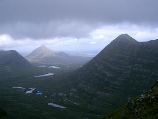
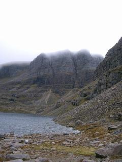
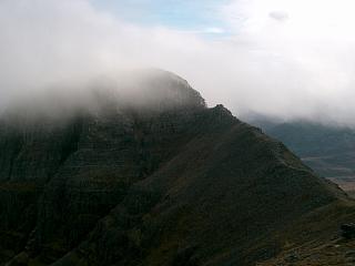
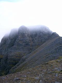
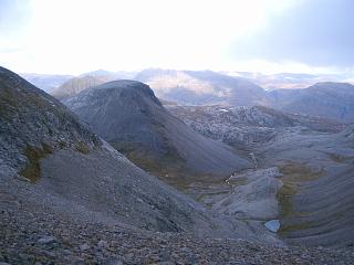
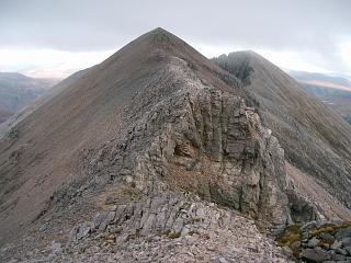
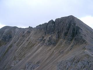
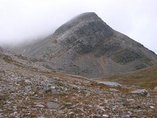
Traverse of this ridge is unquestionably 5*. Note, for example, the stunning views of Coire Mhic Fhearchair from Ruadh-stac Mor with, in the Spring, its snow laden plateau and cornice typically in sun with thick clouds behind. Note also the brilliant turquoise algae around L. Coire Mhic Fhearchair.
Routes: The three routes here include a number of different variations on the standard route and so it is worth looking at all three for ideas. The Beinn Eighe massif includes two Munros, four Munro tops and one Corbett. Route 3 covers all of these in one day, with a little scrambling mixed in. Nevertheless, it fails to provide the full experience as one sees little of the south facing slopes and there's no close contact with Loch Coire Mhic Fhearchair or looking up at the Triple Buttress. So the other routes should certainly be tried.Sail Mhor: Routes 2 and 3 below include a difficult traverse from a'Coinneach Mhor to Sail Mhor with some non-trivial down-climbing (details next). A much easier alternative which still includes Sail Mhor is given in Route 1 which starts with an ascent of the steep but straight-forward slopes below the Triple Buttress from L. Coire Mhic Fhearchair to the col between a'Coinneach Mhor and Sail Mhor. After going out to Sail Mhor, the route ascends to a'Coinneach Mhor and then does a detour to Ruadh-stac Mor and back. This reduces the scrambling to ascent only, and eliminates the route finding problems between a'Coinneach Mhor and Sail Mhor, which only occur in one direction. Of course, once up Sail Mhor the route can be reversed back to L. Coire Mhic Fhearchair and home, enabling the Munro top to be conquered without any scrambling.
Beware of the difficult descent off a'Coinneach Mhor towards Sail Mhor. It requires some easy but sometimes exposed scrambling. (Sail Mhor must be the second most difficult Munro top on the mainland, with Liathach's Meall Dearg being first.) The ridge over to Sail Mhor starts with an exposed scramble down the western edge of the Triple Buttress. (See photo above.) Descend due W from cairn; do not take the neighbouring ridge to right which is the middle of the Triple Buttress. The descent is difficult and very dangerous in poor conditions, especially if there is no visibility. There are usually signs of a path, but some easy path choices lead to cliffs where many feet appear to have trodden incorrectly. This is because the natural build up of fine sand and gravel in gullies through weathering looks just like a path caused by the passage of feet. Often there is no view forward which would allow difficulties to be assessed. However, the rule is easy: return to the crest of the ridge whenever necessary.
At the first difficulty of the traverse to Sail Mhor there is a minor detour to the south side of the ridge, but do not descend more than half way down to the cliffs. Sand rivulets indicate a path which ends at the top of cliffs, but that is because too many people have gone too far when seeking an easy route. Do not attempt to descend the cliffs on the south side. Instead, traverse horizontally back to the crest of the ridge. The cliffs become higher as you progress westwards, so that you should regain the crest close to the point where the cliffs meet it. Allow a few minutes to find the right alternative, and do not be afraid to retrace your steps. If the traverse is done at the right point, it is possible to cross the prominent crest of the ridge and descend easily about 5m on the Triple Buttress side before traversing almost horizontally back to the crest. The crux is then reached: a vertical 3m/10' pitch at the bottom of the descent just round from the crest on the S side. This borders on rock climbing rather than scrambling (see photos). However, it has really good foot and hand holds despite being essentially vertical. It is not at all difficult. A minor pinnacle to the west of all this can be skirted to the south or climbed over, as preferred. (It presents no difficulties.) The return ascent of this ridge is straightforward scrambling; route visibility is much better. Difficulties ascending immediately above the bad step are avoided by going temporarily to the left, i.e. towards the Triple Buttress.
Ascent of Beinn Eighe from Ruadh-stac Beag: The northern outlier Corbett Ruadh-stac Beag is easily reached from the excellent path which starts at the A832 1km north of Kinlochewe – see Route 3. The ridge N from the col at Lochan Uaine is entirely large scree of sharp quartzite at its angle of rest – unpleasant to ascend. The north ridge of Spidean Coire nan Clach can be ascended directly from the col with a bit of scrambling: ascend the screes as far as possible, follow the ledges diagonally upwards to the right until further screes are reached; ascend those screes until the cliffs are attained; then climb the rocks, moving to left or right as necessary to pick the easiest routes. The screes on this side of the col are also very steep, but of much smaller rocks and sand. The rock on the ridge end is crumbling quartzite with plenty of ledges and very good hand and foot holds of sufficient quality for wet and windy weather.
Route 1 (3/4/08): This route starts at the usual car park on the A896
between Liathach and Beinn Eighe. It provides an excellent way to do Sail Mhor,
avoiding route-finding problems and avoiding a descent of the bad step
on the ridge back to a'Coinneach Mhor. Start by ascending from L. Coire Mhic Fhearchair
taking the line of least gradient, initially S then veering almost round to due W,
to arrive at the lowest point of the ridge out to Sail Mhor.
The table below omits the eastern Munro tops of Sgurr Ban and Sgurr nan Fhir Duibhe
(due to lack of daylight) but they can be added as in the GPS link above or as in
Route 2.
Weather (3/4/08):
Slow progress due to heavy wet snow underfoot above 600m.
Persistent rain am. Thick cloud at 400m till 1430,
then rising to 1100m, so blind ascent to Sail Mhor.
| 0930 | Park on A896 at P 6.3 miles W of Kinlochewe, at E end of Liathach. (The parking is set back on N side of road.) |
80 | 0 | 0.0 miles | NG95755685 | Orange |
| 1020 | Take well-engineered path NW by Allt a'Choire Dhuibh Mhoir to ford by stepping stones (only just usable if river in spate) |
345 | 265 | 1.66 miles | NG9467058955 | |
| 1005 | Continue NW to path split at watershed | 390 | 310 | 2.5 miles | NG9345459403 | |
| 1140 -1155 |
Take right fork round W end of Sail Mhor to N end of L.Coire Mhic Fhearchair |
585 | 505 | 4.15 miles | NG9395061099 | Orange |
| Cross outlet from loch & take path to S end of lochan. | 600 | 520 | 4.7 miles | NG94416055 | ||
| 1320 | Ascend Coire Mhic Fhearchair to lowest point of ridge between a'Coinneach Mhor & Sail Mhor |
860 | 780 | 5.1 miles | NG9394360162 | |
| 1340 | NW/N along easy ridge to T Sail Mhor | 980 | 900 | 5.4 miles | NG9381660584 | Just no Orange |
| 1400 | Return S/SE to bad step at col | 875 | 915 | 5.8 miles | NG9408060084 | |
| 1430 | Ascend exposed rocks E back to T a'Coinneach Mhor | 976 | 1015 | 6.1 miles | NG9444560015 | Orange |
| 400m E to col | 945 | 6.25 miles | NG94776005 | |||
| 200m E to E top of a'Coinneach Mhor (cairn) | 954 | 1025 | 6.37 miles | NG9501960099 | ||
| 1455 | NNE to bealach | 868 | 6.53 miles | NG95166030 | ||
| 1520 -1525 |
NNE/N to M Ruadh-stac Mor | 1010 | 1170 | 7.1 miles | NG95146115 | Orange |
| 1545 | Return S/SSW to bealach | 868 | 7.63 miles | NG95166030 | ||
| SW to a'Coinneach Mhor, E top (cairn) | 954 | 1255 | 7.8 miles | NG9501960099 | ||
| Continue 300m SE to minor col | 902 | 7.96 miles | NG95255992 | |||
| SE 100m to minor top | 912 | 1265 | 8.06 miles | NG95335986 | ||
| 1615 | SE 500m to bealach | 825 | 8.36 miles | NG95705953 | ||
| 1645 | Ascend ½ mile ENE to Spidean Coire nan Clach (trig pt) | 972 | 1410 | 8.9 miles | NG96515964 | |
| 1655 | Continue NE 600m to M Beinn Eighe | 993 | 1435 | 9.0 miles | NG96615978 | Orange |
| — | Time permitting, detour E to T Sgurr Ban & T Sgurr nan Fhir Duibhe, returning to M Beinn Eighe (2.0 miles more distance, 400m more ascent) |
|||||
| 1700 | SW 600m to Spidean Coire nan Clach (trig pt) | 972 | 9.15 miles | NG96515964 | ||
| 300yds SSE to cairn at col | 855 | 9.3 miles | NG96605941 | |||
| 1830 | Descend SW into Coire nan Clach on initially clear path then S to A896 near Slugach (or SW to path for car park). (If no cornice, then path E into Coire an Laoigh & down.) |
95 | 10.85 miles | NG96685709 | ||
| 1840 | W along road back to car park | 80 | 1433 | 11.34 miles | NG95755685 | Orange |
Route 2 (26/10/04): This route starts at the usual car park on the A896
between Liathach and Beinn Eighe. Unlike Route 1,
Ruadh-stac Mor is ascended first, followed by a west to east traversal
of the main ridge from Sail Mhor, eventually returning to the starting point.
Weather (26/10/04):
No rain; almost dry feet. Rising clouds, eventually just touching tops.
| 0905 | Park on A896 at P 6.3 miles W of Kinlochewe, at E end of Liathach. (The parking is set back on N side of road.) |
80 | 0 | 0.0 miles | NG95815683 |
| 1005 | Take well-engineered path NW along Allt a'Choire Dhuibh Mhoir to path split at watershed |
390 | 310 | 2.5 miles | NG93405943 |
| 1055 | Take right fork round W end of Sail Mhor to N end of Loch Coire Mhic Fhearchair |
585 | 505 | 4.2 miles | NG94006114 |
| 1155 | Cross outlet from loch and ascend ridge end opposite to ridge end cairn. The ascent is mostly large stone scree and much easier than the sand chute from loch SE up to bealach. |
980 | 900 | 4.95 miles | NG95006148 |
| 1200 | SSE to M Ruadh-stac Mor | 1010 | 930 | 5.15 miles | NG95146116 |
| 1220 | S to bealach | 868 | 5.7 miles | NG95136031 | |
| 1230 | SW to a'Coinneach Mhor (old GR, cairn) | 954 | 1015 | 5.85 miles | NG94996009 |
| W to col | 945 | 6.0 miles | NG94776005 | ||
| 1240 | W to T a'Coinneach Mhor (new GR) | 976 | 1045 | 6.15 miles | NG94536011 |
| Descend W to col, taking note of remarks above. | 865 | 6.5 miles | NG94016014 | ||
| 1325 | NW/N along easy ridge to T Sail Mhor | 980 | 1165 | 6.8 miles | NG93816059 |
| Return S/SE to col | 865 | 7.15 miles | NG94016014 | ||
| 1400 | Ascend exposed rocks back to W top of T a'Coinneach Mhor (again) |
976 | 1285 | 7.5 miles | NG94536011 |
| E 400 yds to col | 945 | 7.65 miles | NG94776005 | ||
| 1410 | E 200yds more back to E top of a'Coinneach Mhor again (cairn) NG950601 |
954 | 1290 | 7.8 miles | NG94996009 |
| Continue 300yds SE to minor col | 902 | 7.95 miles | NG95235997 | ||
| 1420 | SE for 100yds more to minor top | 912 | 1305 | 8.05 miles | NG95355987 |
| SE for 500yds to bealach | 825 | 8.35 miles | NG95725955 | ||
| 1500 | Ascend ½ mile ENE to Spidean Coire nan Clach (trig pt) | 972 | 1455 | 8.9 miles | NG96515965 |
| 1505 | NE 200yds to M Beinn Eighe | 993 | 1475 | 9.0 miles | NG96665981 |
| SE/E for 300yds to col | 900 | 9.25 miles | NG97015980 | ||
| 1530 | ENE 600yds to T Sgurr Ban | 970 | 1545 | 9.6 miles | NG97486004 |
| 1545 | E ¼ mile to col | 845 | 9.85 miles | NG97875999 | |
| 1600 | E 300yds to T Sgurr nan Fhir Duibhe | 963 | 1665 | 10.0 miles | NG98176003 |
| Return W 300yds to col | 845 | 10.2 miles | NG97875999 | ||
| 1625 | ENE ¼ mile to T Sgurr Ban | 970 | 1790 | 10.45 miles | NG97486004 |
| WSW 350 yds to col | 900 | 10.75 miles | NG97015980 | ||
| 1650 | WSW/NW 600yds to M Beinn Eighe | 993 | 1880 | 11.0 miles | NG96665981 |
| 1655 | SW 200yds to Spidean Coire nan Clach (trig pt) | 972 | 11.15 miles | NG96515965 | |
| 300yds SSE to cairn at col | 855 | 11.3 miles | NG96605941 | ||
| 1755 | Take path E into Coire an Laoigh, then S by Allt Coire an Laoigh to A896 (Details above.) |
105 | 12.8 miles | NG97765781 | |
| 1820 | W along road back to car parking | 80 | 1880 | 14.25 miles | NG95815683 |
Route 3 (12/10/06)
This route starts in Kinlochewe and includes (optionally) the Corbett Ruadh-stac Beag.
If this is omitted then it is comparable to Route 2 in ascent and distance.
The final descent into Kinlochewe starts with some interesting pinnacles and concludes with
a fast, easy path. To reach every Munro top, some parts of the ridge need to be traversed twice.
This one repeats different parts from the previous two routes.
Weather (12/10/06): Strong winds and rain all day.
| 0905 | Kinlochewe Hotel | 30 | 0 | 0.0 miles | NH02896192 | |
| 0920 | ¾ mile N along A832 to path end (300m before visitor centre) |
25 | 0 | 0.7 miles | NH02196277 | |
| 1015 | Path W to gate at deer fence | 365 | 340 | 2.45 miles | NG99686221 | |
| 1035 | Take left fork at cairns | 470 | 445 | 3.15 miles | ||
| 1040 | Path W to highest pt | 475 | 450 | 3.2 miles | NG98566253 | |
| 1135 | Contour S across boulder field, descend SW to river and follow path SW up Allt Toll a' Ghuibhais to stream split. |
600 | 600 | 4.45 miles | NG97586087 | |
| 1150 | SW/W to Lochan NE of Lochan Uaine | 725 | 725 | 4.85 miles | NG97046077 | |
| 1220 | N up scree of large sharp quartzite boulders at angle of rest to C Ruadh-stac Beag |
896 | 895 | 5.3 miles | NG97296135 | Orange |
| 1255 | S back to Lochan NE of Lochan Uaine | 725 | 5.75 miles | NG97046077 | ||
| SSW to Lochan Uaine on bealach | 710 | 5.95 miles | NG96796057 | |||
| 1340 | Ascend the ridge end directly to top.
(Up screes first, then diagonally right up quartzite shelves, then up screes to crags, and ascend crags on crumbly quartzite with very secure foot and hand holds.) |
925 | 1110 | 6.2 miles | NG96806018 | |
| 1350 | S on knife-edge ridge to M Beinn Eighe | 993 | 1175 | 6.4 miles | NG96665981 | Orange |
| 1400 -1410 |
SSW to Trig Post | 972 | 6.55 miles | NG96515965 | Orange | |
| 1430 | WSW/W to bealach | 825 | 7.07 miles | NG95725955 | ||
| NW to top | 912 | 1260 | 7.4 miles | NG95355987 | ||
| NW to col | 902 | 7.5 miles | NG95235997 | |||
| 1450 | WNW to a'Coinneach Mhor cairn | 954 | 1320 | 7.65 miles | NG94996009 | |
| W to col | 945 | 7.8 miles | NG94776005 | |||
| 1500 | W to T a'Coinneach Mhor NG944600 | 976 | 1350 | 7.9 miles | NG94536011 | |
| Scramble W down to col (see above for details) | 865 | 8.3 miles | NG94016014 | |||
| 1535 | NW to T Sail Mhor NG938605 | 980 | 1470 | 8.6 miles | NG93816059 | Orange |
| Return SE to col | 865 | 8.95 miles | NG94016014 | |||
| 1600 | Scramble E up to T a'Coinneach Mhor | 976 | 1585 | 9.3 miles | NG94536011 | |
| E to col | 945 | 9.45 miles | NG94776005 | |||
| 1610 | E to a'Coinneach Mhor cairn NG950601 | 954 | 1595 | 9.6 miles | NG94996009 | |
| — | Time permitting, detour to M Ruadh-stac Mor. (This adds 230m ascent and 1½ miles to the total.) |
NG95146116 | ||||
| SE to col | 902 | 9.75 miles | NG95235997 | |||
| SE to minor top | 912 | 1610 | 9.85 miles | NG95355987 | ||
| 1625 | SE to bealach | 825 | 10.15 miles | NG95725955 | ||
| 1645 | E back to Trig Post | 972 | 1760 | 10.67 miles | NG96515965 | Orange |
| 1650 -1655 |
NE to M Spidean Coire nan Clach | 993 | 1790 | 10.8 miles | NG96665981 | Orange |
| col | 900 | 11.05 miles | NG97015980 | |||
| 1720 | ENE to T Sgurr Ban | 970 | 1850 | 11.37 miles | NG97486004 | No Orange |
| col | 845 | 11.6 miles | NG97875999 | |||
| 1745 | E to T Sgurr nan Fhir Duibhe | 963 | 1970 | 11.8 miles | NG98176003 | Orange |
| 1815 | Scramble over sandstone pinnacles NNE to Creag Dhubh |
905 | 2000 | 12.35 miles | Orange | |
| Very fast path E down ridge to about 530m. | 530 | 12.85 miles | NG99376080 | |||
| 1855 | E along flatter ridge to river crossing | 260 | 13.33 miles | NH00126096 | ||
| 1900 | E to gate in deer fence | 255 | 13.4 miles | NH00226096 | ||
| 1930 | Due E along superb path to A896 (I turned right at track) |
41 | 14.85 miles | NH02536107 | ||
| 1940 | N for ½ mile on A896 to Kinlochewe Hotel. | 30 | 2000 | 15.55 miles | NH02896192 |
| Previous | Top | Next |