Previous |
Colin's Munros |
Next |
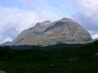
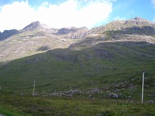
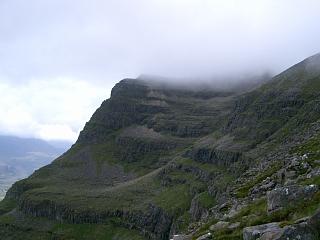
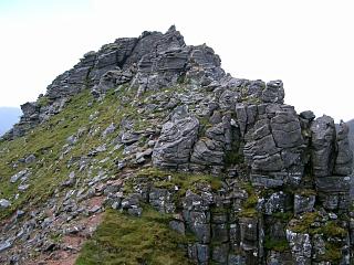
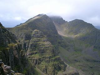
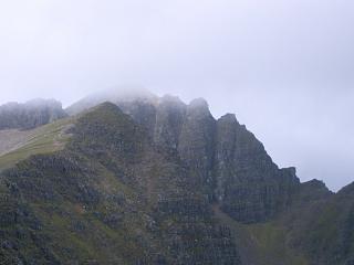
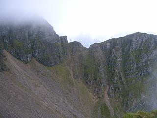
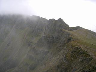
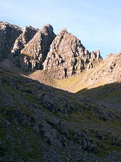
Evaluation: 5 star rating. This is unrivalled in the whole of Scotland! E to W seems the preferable direction.
Kit: Helmet and probably a rope/harness for the Northern Pinnacles (if attempted); poles for steep scree descents. Perhaps a torch as average speed is only 1mph – it will be slower if any heavy gear is taken.
Route: This walk only involves some minor scrambling if Meall Dearg is omitted. If you can get up to the main ridge without a problem, then you should also manage the Pinnacles on the main ridge east of Am Fasarinen without problem. If you can climb a loft ladder, you can manage these pinnacles. Hands are needed mostly just for balance & support. Only at one point on the last (highest) pinnacle do a couple of moves require a good handhold for pulling up. The first, small pinnacle is easily avoided, but is as challenging as the others.
There are excellently constructed paths up both ends of Liathach to the ridge. However, back in 2006, at the west end there was only a standard peaty (lower) or sandy (higher) mess of a path, except for a few hundred yards inside the NTS boundary. Both paths are clearly marked by substantial cairns on the main ridge. The eastern one splits a few yards below the ridge, and so has two cairns a few yards apart at the two lowest points of the ridge, one for each fork. The rock at the east end of the ridge is hard, but from the Pinnacles westwards it is very soft sandstone.
Meall Dearg is a serious proposition requiring a hard hat and previous scrambling experience. It is easily the hardest of the Munro Tops on the mainland. For those doing the tops as well as mountains, there are three main routes for bagging Meall Dearg.
The easiest ascent is from the north-east and starts at Glas-toll Lochain to the north below Am Fasarinen. Ascend into Coire na Caime, then west into Coireag Cham and north-west up an easy, though steep, grassy gully to a col just SW of the lowest point on the ridge from Mullach an Rathain down to Meall Dearg. No scrambling so far. An easy scramble takes one NE to the top of Meall Dearg. No extra safety gear is needed for this approach. The easiest way off the top is probably reversing this route back to Glas-toll Lochain.
There is an alternative but more exposed (and dangerous) ascent from the north-west via Glas-toll Bothain and a narrow rake up to the lowest point between Meall Dearg and Mullach an Rathain. This can also be used in an ascent from the top of Mullach an Rathain. The bottom of the rake is reached by a faint path contouring round the corrie of Glas-toll Bothain at about 850m, and can be gained easily by descending the north ridge of Mullach an Rathain just far enough to obtain easy entry into the coire. It is essential to have enough visibility to pick the rake which leads directly to the lowest point on the ridge. It starts between two noticeable grassy patches, beyond which is the start of another (unwanted) steeper rake and a much smaller grassy patch. The rake is steeply pitched and filled with loose material, mostly larger stones at the bottom thinning to mainly gravel and small rocks higher up. The rocks are very loose and easily dislodged, usually falling the entire length of the rake with increasing speed. It is definitely dangerous and should certainly not be attempted without a helmet or if anyone else is in the rake. It is, however, easy to see if anyone else is in the rake as it is straight, becoming steeper towards the top. The ascent therefore becomes more difficult towards the top. However, descent is easier than ascent as holds are more clearly seen. In both directions walking poles provide much needed extra grip as handholds are very few and far between.
Finally, the third (and hardest) possibility is using the Northern Pinnacles. This involves proper scrambling. There are three pinnacles from the col with Meall Dearg up to Mullach an Rathain. I would only use this route in the direction from Meall Dearg to Mullach an Rathain. Difficulties are reduced by choosing the north-west (right) side of the ridge. None of the vicious vertical cliffs facing one needs to be ascended. The crux of the route I took was a chimney forming the final 3m of the middle pinnacle, which I tackled front on at that point. The highest pinnacle begins with an exposed, horizontal traverse rightwards from the lowest point round to a steep, sandy gully which avoids all the rocks. There are scratch marks and indications of a path over all of the correct route. Do not attempt rocks where there are no scratch marks to indicate previous climbers. Retreat if the going gets too hard and look for an alternative route.
Other routes up Meall Dearg are in the literature, but all are harder and not easily found. Here is the second choice for Meall Dearg (27/6/04):
| 0910 | Park on A896 between Kinlochewe and Torridon,
100yds W of path start beside Allt an Doire Ghairbh (limited parking) |
60 | 0 | 0.0 miles | NG93665664 |
| 1010 | Take well-constructed path up E bank of Allt an Doire Ghairbh. Enter the Toll a' Meitheach and a high grassy corrie to cliffs above a fork in the burn. |
530 | 470 | 0.75 miles | NG93695772 |
| 1030 | At the cliffs take the right fork NE to attain ridge at col. (Do not take the rake ahead when the cliffs are reached; instead turn right on well-defined path up the grassy slope.) |
830 | 780 | 1.0 miles | NG93805808 |
| 1045 | NE along narrow ridge to T Stuc a'Choire Dhuibh Bhig | 915 | 865 | 1.3 miles | NG94255824 |
| 1105 | Return SW to col | 830 | 875 | 1.57 miles | NG93805808 |
| 1120 | NW then W to mini-top | 950 | 985 | 1.8 miles | NG93495819 |
| 1130 | WSW to T Stob a'Coire Liath Mhor | 983 | 1020 | 1.9 miles | NG93325811 |
| 1145 | From here descend straight along crest of ridge SW to col, not to side (despite appearances). |
925 | 2.0 miles | NG93215802 | |
| 1155 | W up ridge to M Spidean a'Choire Leith | 1055 | 1150 | 2.15 miles | NG92945798 |
| For the next descent use compass setting of 220° if necessary. This is slow work over large boulders SW to the col, followed by a small grassy knoll, and then "The Pinnacles" for about 400 yds. Keep on narrow ridge or take exposed path on S side of them. | 875 | 2.5 miles | NG92555755 | ||
| 1300 | T Am Fasarinen (the final, highest pinnacle) | 927 | 1250 | 2.65 miles | NG92345747 |
| 1310 | Ridge W to bump 903 | 903 | 1270 | 2.85 miles | NG92095750 |
| 1315 | Ridge W to bump 900 | 900 | 1290 | 3.0 miles | NG91915750 |
| 1330 | Ridge W to bump | 980 | 1370 | 3.17 miles | NG91615760 |
| 1345 | W/NW to M Mullach an Rathain | 1023 | 1440 | 3.5 miles | NG91185769 |
| Continue 300yds W, then N down ridge for 400yds to about 850m. Contour SE/E along faint path into and round Glas Toll Bothain corrie. Ascend rake (as described above) to col |
925 | 1515 | 3.9 miles | NG91305784 | |
| 1505 | NE to T Meall Dearg | 955 | 1545 | 4.0 miles | NG91425798 |
| 1530 | Return SW to col and descend rake again to Glas Toll Bothain corrie. | 850 | 4.25 miles | NG91155784 | |
| 1605 | Re-ascend S to cairn 100yds W of Mullach an Rathain | 1000 | 1695 | 4.5 miles | NG91105774 |
| From cairn descend gravelly path S (poles a great boon), dropping into Toll Bhan corrie (~650). | 650 | 4.9 miles | NG91225712 | ||
| 1645 | Follow path down to exit from the corrie | 400 | 5.33 miles | NG91655665 | |
| 1800 | Take rough path ENE near the Allt an Tuill Bhain to road. (Path goes due S to join road at patch of forest) |
25 | 6.1 miles | NG91395541 | |
| 1830 | E along road back to car park | 60 | 1730 | 7.8 miles | NG93665664 |
Here are the first & third of the above routes to/from Meall Dearg (10/10/06):
| 0905 | Park on the A896 at the car park between Liathach and Beinn Eighe |
80 | 0 | 0.0 miles | NG95765686 | Orange |
| 0950 | Path N/NW to stepping stones over Allt a' Choire Dhuibh Mhoir |
345 | 265 | 1.7 miles | NG94685895 | |
| 1005 | Path NW/W to path split at watershed | 390 | 320 | 2.55 miles | NG93415942 | |
| 1105 -1110 |
SW across country to Loch a'Ghlas-tuill (on north side of Liathach) |
515 | 490 | 3.55 miles | NG92175846 | |
| 1145 | Ascend S into Coire na Caime. (Here attempted ascent of gully on S face of Meall Dearg but retreated.) |
675 | 660 | 4.2 miles | NG91725790 | |
| 1205 | Ascend W into Coireag Cham | 785 | 770 | 4.3 miles | NG91505785 | |
| 1225 | Ascend steep but straightforward grassy gully NW to col on ridge just S of lowest pt |
915 | 890 | 4.5 miles | NG91305784 | |
| 1240 | NE along ridge to T Meall Dearg | 955 | 930 | 4.6 miles | NG91425798 | Orange |
| 1245 | Return SW to col | 915 | 4.7 miles | NG91305784 | ||
| 1250 | Scramble S to top of 1st pinnacle (ascend W side) | |||||
| 1305 | Scramble to top of 2nd pinnacle (nasty 3m chimney at top) | |||||
| 1320 | Ascend sandy stone chute on W side of 3rd pinnacle to M Mullach an Rathain |
1023 | 1040 | 4.85 miles | NG91185769 | No Orange |
| Ridge SE to bump | 970 | 1060 | 5.15 miles | NG91615760 | ||
| Ridge E to bump | 903 | 1080 | 5.45 miles | NG92095750 | ||
| Ridge SE/E to bump | 895 | 1095 | 5.55 miles | NG92225739 | ||
| NE to col | 875 | 5.6 miles | NG92285744 | |||
| 1400 | ENE to T Am Fasarinen (the highest pinnacle) | 927 | 1150 | 5.7 miles | NG92395749 | Orange |
| E over "The Pinnacles" (about 400 yds) to col | 875 | 5.8 miles | NG92555755 | |||
| 1500 -1505 |
Path NE through very stoney terrain (large boulders) up to M Spidean a'Choire Leith |
1055 | 1335 | 6.15 miles | NG92945798 | Orange |
| ENE to col | 925 | 6.3 miles | NG93215802 | |||
| 1525 | NE to T Stob a'Coire Liath Mhor | 983 | 1390 | 6.4 miles | NG93325811 | |
| NE to mini-top | 955 | 1400 | 6.5 miles | NG93505819 | ||
| 1550 | E/SE/E to col | 830 | 6.75 miles | NG93805808 | ||
| 1600 -1605 |
NE to T Stuc a'Choire Dhuibh Bhig | 915 | 1485 | 7.05 miles | NG94255824 | Orange |
| 1615 | Return SW to col with cairn | 830 | 1495 | 7.35 miles | NG93805808 | |
| 1645 | Descend path S down grassy gully, then
cross almost horizontally W before reaching tier of crags round corrie. S to path beside main stream in Toll a' Meitheach corrie. |
530 | 7.6 miles | NG93695772 | ||
| 1740 | Descend well-constructed path on E bank of Allt an Doire Ghairbh to end of path at A896 |
60 | 1495 | 8.3 miles | NG93665664 | |
| E on A896 back to car park | 80 | 1520 | 9.8 miles | NG95765686 | Orange |
| Previous | Top | Next |