Previous |
Colin's Munros |
Next |
Reception: Good Orange reception on most Munro tops; none at Linn of Dee.
Access: Bike used but only helpful from Linn of Dee to Derry Lodge.
The time & effort to go further towards the Lairig Ghru is not worth it,
especially as it is so easy to descend the S ridge of Derry Cairngorm to Derry Lodge.
The anti-social method of path construction has made the over-frequent burn
crossings very difficult without dismounting. In the '60s one could also
cycle easily up Glen Derry, but this is no longer possible either.
Route:
The North top of Ben Macdui (NN991995) and Stob Coire Sputan Dearg (NN998985)
were deleted from the Munro tops list in 1997 and 1974 respectively.
Both are easy optional extras.
However, Sron Riach (NN999977), with a similar amount of ascent, remains a top.
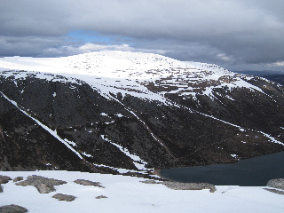
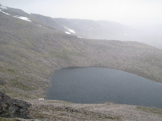
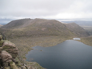
Although it requires a bit of a detour, the superb views of Lochan Uaine make
it a highlight of the walk and it should not be missed.
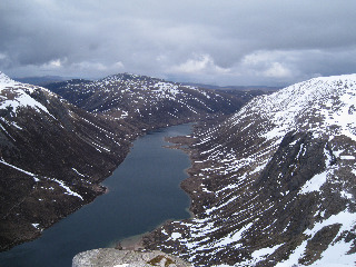
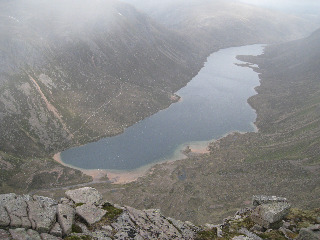
The other unmissable viewpoint is of Loch Avon from just north of the Munro top Carn Etchachan.
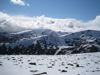
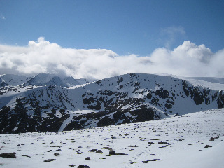
Those skipping the Munro tops will miss some of the very best mountain scenes in the whole country.
By April 2016 the Derry Burn bridge at Derry Lodge had been repaired after being washed away in
August 2014. Immediately after crossing this bridge there are three paths:
Left is the Lairig Ghru path, straight on is the Carn Crom path, right is for Glen Derry.
I believe there is still a bridge at NO01339423 for crossing the Luibeg Burn.
Most people, me included, just cross the burn directly by boulder hopping but this is not easy
and would not be advisable after heavy rain.
Work on the Carn a' Mhaim path has now made its junction with the Lairig Ghru path very clear.
The only boggy section on the route is immediately after crossing the Derry Burn.
Traversing over to Sron Riach from the path between Carn a' Mhaim and Ben Macdui
is bouldery and exposed in winter conditions. There are several other boulder fields
on the route when away from the standard paths.
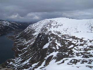
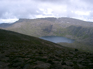
The only significant route finding problem is contouring round the cliffs SW of Loch Etchachan.
My route there attempts to avoid any unnecessary ascent but in practice it can't be avoided
because of the frequent rocky outcrops and cliffs. They can be negotiated easily
if there is visibility but in cloud it might be wiser to continue south to the top of the ridge at
NN99939949 before turning SE towards the main Ben Macdui path from Loch Etchachan.
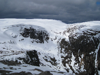
These cliffs are shown in the last photograph above.
Weather 15/8/05: AM: in cloud till 1140. Low cloud, rising & clearing, showers.
PM: high cloud with sunny intervals and strong breeze.
Strongs winds are funnelled over col between Carn a' Mhaim & Ben Macdui
and also over the ridge out to Carn Etchachan.
4/6/09: Cold but light E wind, 0°C on tops, hail/snow showers. Little sun.
Cloud down on Ben Macdui, but other tops free.
Terrain: Slower terrain of large boulders over parts of Ben Macdui, Carn Etchachan,
& Derry Cairngorm. Otherwise mostly granite sand and smaller, sparser rocks
with most paths constructed against erosion.
| 15/8/05 | 4/6/09 | Description | Alt. | Asc. | Dist. | Grid Ref. | Mob. |
| 0925 | 0750 | Park at Linn of Dee | 375 | 0 | 0.0 miles | NO0633289766 | No Orange |
| 0935 | 0800 | Cycle N on path through forest from parking then track N to Bridge over Lui Water |
400 | 42 | 1.2 miles | NO0639291470 | |
| 0955 | 0815 -0820 |
Cycle to Derry Lodge & (4/6/09) leave bike | 430 | 72 | 3.1 miles 0.0 miles | NO0411093381 | |
| 1025 | 0850 | Cycle/walk Lairig Ghru path W to split/fence "gate" before Luibeg Bridge |
460 | 105 | 1.7 miles | NO01829383 | |
| 0855 | Luibeg Ford (or Bridge further N) | 470 | 115 | 1.9 miles | NO01559389 | ||
| 0900 | Path W to 2nd "gate" in deer fence | 510 | 155 | 2.1 miles | NO01259393 | ||
| 0905 |
Path W to just before giant granite slabs at crest, where path up ridge to Carn a' Mhaim starts |
550 | 215 | 2.35 miles | NO0100893872 | ||
| NW up recently constructed ridge path, by-passing cairn at 1014, & W to col |
999 | 650 | 3.35 miles | NN99689495 | |||
| 1135 | 1000 -1010 |
Path NW to M Carn a' Mhaim | 1037 | 690 | 3.6 miles | NN99459520 | Orange |
| 1205 | 1040 | Path NNW to lochans near bealach. | 805 | 700 | 4.9 miles | NN98739701 | |
| 1300 | – | EITHER: Follow Carn a' Mhaim ridge path up ridge of Ben Macdui towards top 1249. When it disappears in mass of boulders head NE for main path at col |
1232 | 1130 | 6.1 miles | NN9957098791 | |
| – | OR: (to go to Sron Riach for view of Lochan Uaine) Head initially NE up path, then diagonally E to col |
1085 | 980 | 5.85 miles | NN99829791 | ||
| – | 1115 -1120 |
SE from col to T Sron Riach | 1110 | 1010 | 6.0 miles | NN9999597798 | Orange |
| – | NW back to col | 1085 | 6.1 miles | NN99829791 | |||
| – | 1145 -1148 |
Continue N to X Stob Coire Sputan Dearg | 1249 | 1172 | 6.6 miles | NN9979998638 | |
| – | 1155 | NW to path near col | 1232 | 6.7 miles | NN9957098791 | ||
| 1315 -1325 | 1207 -1218 |
THEN: NW passed old ruin to M Ben Macdui trig pt |
1309 | 1250 | 7.2 miles | NN9889498941 | Orange |
| EITHER NNE (along boundary) to col | 1276 | 7.4 miles | NN99029922 | ||||
| 1335 | 1230 | N (along boundary) to Ben Macdui N top | 1295 | 1270 | 7.6 miles | NN9914799597 | |
| 1400 | 1250 | E down boulders to Garbh Uisge Mor, then N beside stream to large lochan |
1105 | 8.4 miles | NH99890020 | ||
| OR follow main path E until boundary turns north, then follow boundary N to large lochan |
1105 | NH99890020 | |||||
| THEN NNE to bump with lochan. | 1117 | 1280 | 8.5 miles | NJ00070034 | |||
| NE to col | 1095 | 8.7 miles | NJ00230053 | ||||
| 1415 | 1302 | N to T Carn Etchachan | 1120 | 1305 | 8.9 miles | NJ00320091 | No Orange |
| – | 1307 | Continue 250m N to cairn for superb view of Loch Avon & surrounding crags |
1110 | 9.05 miles | NJ0034501180 | No Orange | |
| 1415 | 1317 | Return S to T Carn Etchachan | 1120 | 1315 | 9.2 miles | NJ00320091 | No Orange |
| Return S to first col | 1095 | 9.45 miles | NJ00230053 | ||||
| SW to bump with lochan. | 1117 | 1335 | 9.6 miles | NJ00070034 | |||
| 1430 | 1335 | SW to large lochan | 1100 | 9.75 miles | NH99890020 | ||
| S to main bealach | 1105 | 9.9 miles | NH99830000 | ||||
| 1455 | 1356 | Contour horizontally S/SE/E round corrie below rock falls as far as ridge crest at top of cliffs. Then descend E for 150yds with cliffs on left and slabs on right, losing about 60m altitude until level with col of Creagan a' Choire Etchachan opposite at 1053m. Then contour horizontally to main path. OR Head S on boundary up to ridge crest (under 100m ascent) then SE down to main path. |
1050 | 1345 | 10.6 miles | NO0055099525 | |
| E to col by Creagan a' Choire E. | 1053 | 1350 | 10.8 miles | NO00949964 | |||
| 1505 -1515 | 1410 -1415 |
E to T Creagan a'Choire Etchachan | 1108 | 1405 | 10.9 miles | NO01189959 | Orange |
| S/SE/E to col W of Sgurr an Lochan Uaine | 939 | 11.7 miles | NO02219907 | ||||
| 1540 | 1445 | E to T Sgurr an Lochan Uaine | 983 | 1445 | 11.9 miles | NO02589911 | No Orange |
| Return W to col | 939 | 12.1 miles | NO02219907 | ||||
| 1615 | 1525 -1535 |
WSW to path on Derry Cairgorm N ridge Then S/SE to M Derry Cairngorm |
1155 | 1665 | 13.15 miles | NO0174897993 | Orange |
| S down ridge to col before cairn at 1040. | 1025 | 13.55 miles | NO02029749 | ||||
| 1700 | – | EITHER: Fast descent SW over easy ground to join well-engineered path from Ben Macdui. |
560 | 14.85 miles | NO01069561 | ||
| 1730 | – | Bike at path split near Luibeg Bridge | 500 | 16.1 miles | |||
| 1730 | – | Cycle E to bridge over Derry Burn | 425 | 17.65 miles | NO0404893520 | ||
| – | 1550 | OR: S down ridge to X Little Cairngorm | 1040 | 1680 | 13.7 miles | NO02019727 | |
| – | 1615 | S to col. From here the path contours leftwards, avoiding Carn Crom. |
835 | 14.65 miles | NO02469579 | ||
| – | 1625 | Optionally: Continue S up ridge to Carn Crom | 890 | 1735 | 14.95 miles | NO0235295384 | |
| – | 1635 | E back to constructed path down | 800 | 15.2 miles | NO0274395281 | ||
| – | 1650 | SE to bluff, a few metres beyond start of descent | 636 | 16.0 miles | NO03559425 | ||
| – | 1700 & 1705 |
Left off ridge, then right on path under cliffs down to deer fence & two stiles |
510 | NO03809401 | |||
| 1710 | Path SE to bridge over Derry Burn | 425 | 16.6 miles | NO0404893520 | |||
| 1755 | 1715 -1720 |
THEN: E to Derry Lodge | 430 | 1740 | 16.75 miles 0.0 miles | NO0411093381 | |
| 1810 | 1735 | Cycle S to bridge over Lui Water | 400 | 1740 | 1.9 miles | NO0639291470 | |
| 1820 | 1745 | Cycle S to Linn of Dee | 375 | 1755 | 3.1 miles | NO0633289766 | No Orange |
| Previous | Top | Next |