Previous |
Colin's Munros |
Next |
Route – Remarks on Beinn na Lap:
The circuit of Loch Ossian, climbing the three Munros of Carn Dearg,
Sgor Gaibhre & Beinn na Lap, is only 10% more
effort than a trip up Ben Nevis.
Beinn na Lap is a very short walk on its own, being just six miles and 550m of ascent.
It is easily omitted from the round, saving 3.6 miles and the 550m ascent.
Such an omission is a good safety margin if a train needs to be caught at the end of the day.
Moreover, Beinn na Lap and the Corbett Leum Uilleim on the west side of Corrour station
together give two short walks which can be done in one seven hour day (12 miles and 1080m ascent).
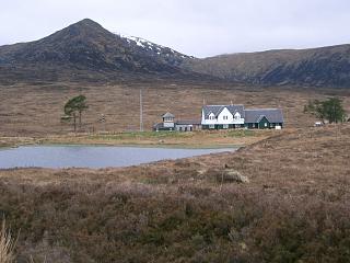
In the full circuit below, heading SW from Corrour Lodge, it is debatable
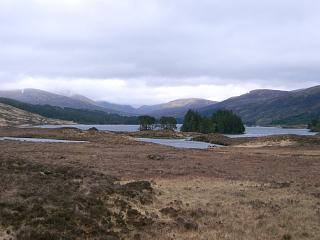
where the best point is to leave the track along Loch Ossian to ascend Beinn na Lap.
The main obstacle is the forestry.
One possibility is to follow fire breaks from NN40666958 to NN40346963
and then a mile of bogland before the main ascent starts.
This would save 2½ miles along the good lochside track,
and substitute 2 miles of mountain path with 2 miles of pathless ground.
However, the start of the fire break is difficult to find without GPS.
It is probably easiest to take the normal path from the west end of the loch.
This starts at the first bend north of the track fork at NN36696731.
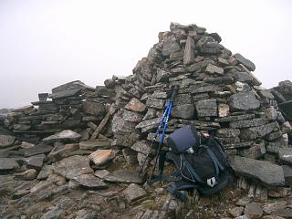
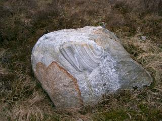
Note that the summit of Beinn na Lap is not at the round shelter but three hundred yards or so
further on, just beyond a lochan at a substantial cairn with shelter wall, as illustrated above.
Transport: Below is an extract from the ScotRail West Highlands timetable up to 14th Dec 2019. Then the times had not changed by more than a minute ot two over the dozen years that had passed since I did the walk with the unfortunate exception that the earliest northbound and latest southbound trains are now apparently restricted to sleepers only. Here is a link to the full West Highland line timetable.
|
|
If access to the Caleonian Sleeper is possible, a fit person can easily complete the walk
between the first and last trains from Tyndrum Upper to Corrour Station and back,
obviating the need to stay at Corrour or to make a return trip to complete
the Munros there – until, of course, you want to return to do them again!
However, there are too few trains to do it on a Sunday, and that way you'll
probably have to skip either a cooked breakfast or an evening meal on the day you choose.
Nowadays I would probably take trains from Tulloch to Corrour and back on the day
to enable overnight access to a car wherever I was staying.
There is a
restaurant
at Corrour station for an evening meal.
Booking is usually essential and portions are very generous!
There is accommodation at both
Corrour and
Tulloch
stations as well as at
Loch Ossian Youth Hostel.
Terrain:
There are a number of miles of excellent track, especially on the north side of
the loch, and quite a few miles of good paths.
Some poor boggy ground, mostly at the start of the walk, but not too much of it.
The table below gives the detail of this.
At the turn-off to the youth hostel, make sure to turn right up the well-made track
or, shorter, look out for a path crossing from the lochside track over to the upper track.
From Peter's Rock to the NW ridge of Carn Dearg, I would continue S for 350yds
along the well-built track to the main corrie stream and then follow a path
up its north bank. This path continues on the north bank of the right hand burn
when the stream first splits in two, but eventually disappears before the ridge is attained.
Weather:
10°C at car; overcast, occasional light showers, cloud base 700-800m.
| 0855 | Arrive at Corrour Station | 410 | 0 | 0.0 miles | NN35626641 | No Orange |
| 0910 | Track ENE to path end by Loch Ossian Youth Hostel | 390 | 1.1 miles | NN37186695 | ||
| 0945 | Wet, peaty track E to Peter's Rock (now an excellent surface) | 515 | 130 | 2.5 miles | NN39356700 | |
| 1040 -1045 |
E/SE without path over wet, peat hacks to
M Carn Dearg Hereafter good, firm ground with fast path along ridges. |
941 | 555 | 4.25 miles | NN41776619 | Orange |
| 1115 -1120 |
ENE to Pass at Mam Ban | 725 | 565 | 5.35 miles | NN43256697 | |
| 1140 -1145 |
ENE to M Sgor Gaibhre | 955 | 800 | 6.15 miles | NN44486742 | weak Orange |
| 1155 | NNW to Bealach nan Sgor | 802 | 6.5 miles | NN44266790 | ||
| 1205 -1210 |
N to T Sgor Choinnich | 929 | 925 | 6.77 miles | NN44376833 | No Orange |
|
Head WNW directly towards Corrour Shooting Lodge. Good firm terrain down to 700m, then poor wet peaty slopes. At bottom, go along track into forest, ignoring the pigeon shooting sign else you end up in very wet, deep bogs. |
||||||
| 1305 -1310 |
Bridge over R. Ossian at NE end of L.Ossian | 385 | 950 | 9.2 miles | NN41276964 | |
| 1400 | Take excellent, surfaced, logging road round the Lodge, then SW along NW edge of loch to far end of forest. The road can be left earlier – see above. |
390 | 980 | 12.5 miles | NN36916740 | |
| 1510 -1515 |
NW to main path, path N to ridge, then NE up ridge to M Beinn na Lap. |
937 | 1525 | 14.25 miles | NN37626957 | Orange |
| 1600 | Return SW down ridge path, then S to road at road junction by Ruigh Nighean Ailein (Path not always obvious, but easy slopes & terrain.) |
410 | 16.05 miles | NN36736724 | ||
| 1620 | S to road junction near Youth Hostel | 390 | 16.35 miles | NN36836693 | ||
| 1635 | Return WSW back to Corrour Station | 410 | 1545 | 17.2 miles | NN35626641 | No Orange |
| Previous | Top | Next |