

Previous |
Colin's Munros |
Next |
Access: Park car at east end of walk, and cycle along A87 from there to west end of walk
(or leave bike at west end and drive to east end to do the walk in reverse).
Route: Another big day to include all the Munro Tops as well!
A similar route from a base in Glen Affric has marginally less ascent,
(see Route 2 below) but the walk in may have a different length depending on the starting point,
and there is non-negligible ascent between the Glen Affric car park and Strawberry Cottage
where the second route starts.
Terrain:
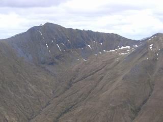
The ridge S from Mullach Fraoch-choire to the col is knife edge with pinnacles.
It requires crampons, ice axe and courage if there is any snow at all.
Lots of exposure! The route goes over almost all of the pinnacles.
In winter conditions the descent from the SSE top of A'Chralaig towards A'Chioch
requires going over a cornice at its thinnest point just by the cairn on top 1051,
and descending over steep ice. Again, ice axe and crampons are essential.
This is the most likely part to be iced up of the whole route below.
Weather:
Frequent, prolonged heavy showers, occasionally hail, sometimes wet snow, from 0700.
Cloud level base about 3000' touching Munro tops, occasionally lifting higher & clearing tops.
| 0555 | Park car on A87 in section of old road near bridge over Allt Corie nan Clach |
235 | 0 | 0.0 miles | NH12411050 |
| 0610 | Cycle 2.5 miles west to start of An Caorann Mor track to Glen Affric |
230 | 0 | 2.5 miles 0.0 miles | NH09201206 |
| 0655 | N to track end and start of poor, wet, peaty path. | 360 | 130 | 2.0 miles | NH07951505 |
| 0715 | Path N to major burn 300m S of boundary | 420 | 190 | 2.6 miles | NH07751595 |
| Path N to highest point & watershed by lochan | 430 | 200 | 2.75 miles | NH07801615 | |
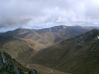
| 0830 | Ascend NE/E round into to Coire Odhar & climb SE to col – see photo above. |
949 | 720 | 3.9 miles | NH09361644 |
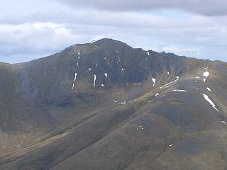
| 0855 | N to M Mullach Fraoch-choire
(omitted ENE Top 1047 NH100174 – not a Munro) |
1102 | 870 | 4.45 miles | NH09491716 |
| 0915 | Return S to col (scenic ridge – see photo above) | 949 | 4.95 miles | NH09361644 | |
| 0920 | SW to T Stob Coire na Cralaig | 1008 | 930 | 5.1 miles | NH09131631 |
| 0925 | S to col | 952 | 5.3 miles | NH09211603 | |
| 0955 | S to M A'Chralaig (Garbh-leac) (Monumental cairn visible from Cluanie Inn) |
1120 | 1100 | 6.1 miles | NH09421481 |
| SSE for 0.3 miles to top (Actually cut corner, but better to go to top) |
1051 | 1105 | 6.4 miles | NH09721445 | |
| 1010 | NE away from main ridge to col. | 916 | 7.0 miles | NH10461494 | |
| 1055 | NE to T A'Chioch | 947 | 1130 | 7.3 miles | NH10841528 |
| Return SW to col. | 916 | 7.6 miles | NH10461494 | ||
| Continue SW along ridge for further 300yds | 925 | 1140 | 7.8 miles | NH10231476 | |
| 1145 | Contour down to Bealach Choire a'Chait | 727 | 8.4 miles | NH11001420 | |
| Contour E round edge of Toll Easach at 750m | 750 | 1220 | 9.2 miles | NH12201415 | |
| 1245 | Ascend NE to col | 914 | 1385 | 9.83 miles | NH12971477 |
| 1300 | NE to M Sail Chaorainn S Top (small cairn) | 1002 | 1475 | 10.3 miles | NH13311547 |
| N to col | 960 | 10.5 miles | NH13391574 | ||
| 1320 | N to T Carn na Coire Mheadhoin (large cairn) (Cairn is slightly misplaced, 10m from actual top) |
1001 | 1515 | 10.63 miles | NH13421592 |
| NE then N to col | 890 | 10.95 miles | NH13571634 | ||
| 1345 | NE to T Tigh Mor na Seilge (NNE Top) | 929 | 1555 | 11.3 miles | NH14021664 |
| Return SW then S along ridge to col | 890 | 11.65 miles | NH13571634 | ||
| 1410 | T Carn na Coire Mheadhoin (mid Top) | 1001 | 1665 | 11.95 miles | NH13421592 |
| SSW to col | 960 | 12.07 miles | NH13391574 | ||
| 1425 | M Sail Chaorainn, S Top (again) | 1002 | 1705 | 12.25 miles | NH13311547 |
| 1445 | SSW to col (omitted X Carn a Mhadaidh-ruaidh, 921) |
914 | 12.75 miles | NH12971477 | |
| 1515 | S to M Sgurr nan Conbhairean | 1109 | 1900 | 13.34 miles | NH12981389 |
| 1540 | WSW to T Drochaid an Tuill Easaich | 1001 | 1933 | 13.95 miles | NH12091342 |
| ENE/ESE to Glas Bhealach | 965 | 1963 | 14.6 miles | NH12971334 | |
| 1610 | E to 1st cairn Creag a'Chaorainn | 1993 | 14.85 miles | NH13301315 | |
| 1615 | E to T Creag a'Chaorainn top (2nd cairn) | 998 | 2000 | 15.1 miles | NH13721314 |
| SSE (over bump) to bealach | 890 | 2005 | 15.55 miles | NH14151260 | |
| 1640 | ESE to M Carn Ghluasaid | 957 | 2075 | 15.85 miles | NH14601251 |
| Descend SW ridge by path to old military road (Watch, as the path continues SE to Lundie) |
17.65 miles | NH13291046 | |||
| 1820 | Military Rd (a wet path) back to A87. (Drive along A87 to collect bike.) |
230 | 2075 | 18.3 miles | NH12411050 |
Access: Drive SW from Cannich along Glen Affric to Loch Affric.
Then walk or cycle to the track end at the River Affric by Strawberry Cottage (NH13352063).
Route: A similar route from Lundie on Loch Cluanie requires marginally more ascent.
However, the walk in may have a different length depending on the starting point of
the Glen Affric version. A start from the car park adds another 5.0 miles and 90m ascent
each way, but this can be cycled.
Terrain: See the warnings above about the ridge S from Mullach Fraoch-choire
to the col and the descent from A'Chralaig towards A'Chioch.
Weather: Sunny intervals, cold but light east wind, dry,
slowish snow down to 2000', freezing level below 3000'.
| 0605 | Strawberry Cottage | 235 | 0 | 0.0 miles | NH13202067 | No Orange |
| Footbridge to S side River Affric | 235 | 0.1 miles | NH13322050 | |||
| 0615 | Path SW to footbridge over Allt na Ciche | 240 | 5 | 0.4 miles | NH1298220285 | |
| 0645 | Track to gate in deer fence | 305 | 75 | 1.4 miles | NH1159220024 | |
| 0710 | Follow track W to gate in deer fence above Allt Fraoch-choire |
370 | 140 | 2.03 miles | NH1057019624 | |
| 0720 | Track SW to where deer fence crosses river (Don't leave the track earlier.) |
440 | 210 | 2.53 miles | NH09941915 | |
| 0840 | Cross Allt Fraoch-choire, ascent NW to ridge and follow ridge SW to flat point at bend |
858 | 640 | 3.8 miles | NH08601830 | |
| 0900 | SSE to minor top after rise on ridge | 983 | 770 | 4.4 miles | NH09101750 | |
| 0930 | SW to M Mullach Fraoch-choire
(NE top NH100174, 1047m, is no longer a Munro top) |
1102 | 900 | 4.7 miles | NH09491715 | No Orange |
| 1015 | S to col (excellent scenic ridge) | 949 | 5.25 miles | NH09351642 | ||
| 1025 | SW to T Stob Coire na Cralaig | 1008 | 960 | 5.4 miles | NH09131631 | No Orange |
| S to col | 952 | 5.6 miles | NH09191606 | |||
| 1125 -1130 |
S to M A'Chralaig (Huge cairn) (Orange between here and next pt) |
1120 | 1130 | 6.4 miles | NH09431478 | ~Orange |
| 1155 | SSE to minor top (Don't cut corner) | 1051 | 1130 | 6.7 miles | NH09731445 | |
| Optional Detour NE to col (for Munro Top) | 916 | 7.07 miles | NH10471496 | |||
| 1235 | NE to T A'Chioch (A little trodden top with spectacular views.) |
947 | 1160 | 7.57 miles | NH1089415357 | No Orange |
| Return SW to col | 916 | 7.9 miles | NH10471496 | |||
| 1255 | Continue SW along ridge for 300m | 925 | 1170 | 8.07 miles | NH1026914794 | |
| 1325 | SSE/ESE to Bealach Choire a'Chait | 727 | 8.7 miles | NH11001420 | ||
| 1425 | SE to T Drochaid an Tuill Easaich | 1001 | 1445 | 9.55 miles | NH12061343 | No Orange |
| Ridge NE to col, then contour E/SE to S ridge of S. nan C. and Glas Bhealach |
965 | 1475 | 10.2 miles | NH12961334 | ||
| ESE to 1st cairn Creag a'Chaorainn | 997 | 1505 | 10.4 miles | NH13301315 | ||
| 1515 | E to T Creag a'Chaorainn (E cairn) | 998 | 1510 | 10.7 miles | NH1371113166 | No Orange |
| SSE over bump to col | 890 | 1515 | 11.15 miles | NH14101263 | ||
| 1540 | ESE to M Carn Ghluasaid | 957 | 1583 | 11.45 miles | NH14551250? | No Orange |
| Return WNW to col | 890 | 11.75 miles | NH14101263 | |||
| 1610 -1615 |
Path NNW back to lower W cairn of Creag a'Chaorainn |
995 | 1690 | 12.35 miles | NH13301316 | No Orange |
| W/WNW back to Glas Bhealach | 965 | 12.6 miles | NH12961334 | |||
| 1650 | N to M Sgurr nan Conbhairean | 1109 | 1837 | 12.95 miles | NH12981390 | No Orange |
| 1710 | NNE to col (omit X Carn a Mhadaidh-ruaidh, 921) |
914 | 13.55 miles | NH12951480 | ||
| 1735 | NE to M Sail Chaorainn (small cairn) | 1002 | 1925 | 14.05 miles | NH13311546 | Orange |
| N to col | 960 | 14.25 miles | NH13381575 | |||
| 1750 -1755 |
N to T Carn na Coire Mheadhoin, large cairn (misplaced by 10 yds from top) |
1001 | 1965 | 14.35 miles | NH13421592 | Orange |
| NE then N to col | 890 | 14.65 miles | NH13531633 | |||
| 1820 | NE to T Tigh Mor na Seilge | 929 | 2005 | 15.0 miles | NH14041660 | Orange |
| Due W to plateau edge | 800 | 15.4 miles | NH13301665 | |||
| 1915 -1920 |
W by burn to Gate in deer fence at confluence of burn with Allt na Ciche |
340 | 16.2 miles | NH12251700 | ||
| 1935 | Path to 1st footbridge over Allt na Ciche | 320 | 16.7 miles | NH1226217818 | ||
| Path N to start of track | 300 | 17.1 miles | NH12061840 | |||
| 2000 | Excellent track to gate in fence | 255 | 18.2 miles | NH1272019879 | ||
| 2015 | Track N to bridge over R.Affric & Strawberry Cottage |
235 | 2010 | 18.9 miles | NH13202067 | No Orange |
| Previous | Top | Next |