Previous |
Colin's Munros |
Next |
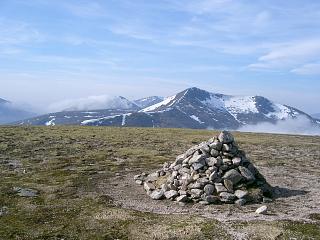
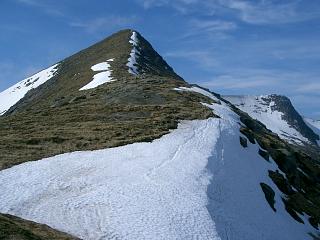
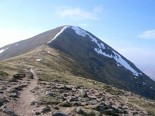
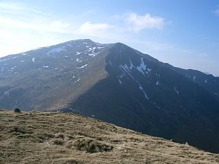
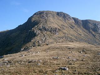
Access: Park 10.3 miles down Glen Etive from the A82.
Route: A good, pleasant length for a full day’s walking.
Rocky outcrops only on N and E faces of these mountains, but W faces are all scree/grass/heather.
So best to go E to W for views and for ease of walking, especially as east faces
retain snow longer – but one may then be walking into the prevailing wind.
Poor paths at eastern end, but improving as one goes west.
Also, no fence or wall on ridge boundary.
This is one useful way of including Meall nan Eun in a ridge walk.
Otherwise it makes for a rather long walk in and out for just a single hill.
There are several straightfoward routes up it from Glenceitlein in Glen Etive,
e.g. via either of the two bealachs at the head of Glen Ceitlein
on either side of Meall nan Eun, or directly SW on the vague path given by OpenStreetMap.
The climb from the northern bealach is over very nice granite slabs,
whereas the climb up to the western bealach is steeper but allows one to leave
any unnecessary kit for collection on return from the summit.
On the descent after Glas Bheinn Mhor one can continue W to the bealach between Meall nan Tri Tighearnan
and Beinn Starav and take the path down the Allt nam Meirleach
or take the north ridge of Meall nan Tri Tighearnan which has better views
and evening sun. However, for this choice the descent onto the
ridge is initially tricky if there is no visibility.
Alternatively, return east to the bealach and descend on the east side of the Allt Mheuran.
Those going in the opposite direction should have no difficulty ascending SSE
from the path by the Allt nam Meirleach directly to the summit of Glas Bheinn Mhor.
It is steep and one keeps to the west side of the ridge to avoid the rocky outcrops.
The historic right of way through Coileitir has been fenced off and re-routed
behind the farm through very nasty, wet, peaty terrain.
It is now best to follow the new hydro power track beside the river
to a bridge over the Allt nam Meirleach.
The 1:50000 map would avoid the need for two 1:25000 maps.
Weather 20/3/05: Walking into sun & breeze in Glen Ceitlein. Hazy with cloud in passes.
21/9/10: Overcast, showers, warm, 14°C at car.
| 20/3/05 | 21/9/10 | Description | Ht. | Asc. | Dist. | Grid Ref |
| 0835 | 0740 | From A82 drive 10.3 miles down Glen Etive. Park opposite track down to bridge over R. Etive |
40 | 0 | 0.0 miles | NN13714686 |
| 0840 | 0745 | Track E to bridge over R. Etive | 20 | NN14044683 | ||
| 0855 | 0805 | Left track NE to bridge over Allt Ceitlein | 30 | 10 | 1.15 miles | NN14824775 |
| 0900 | 0810 | Track E to sheep pens | 57 | 40 | NN15174768 | |
| 0930 | 0840 | Take poor, unreliable path ESE by Allt Ceitlein to crossing of tributary burn from east. |
130 | 110 | 2.35 miles | NN16504708 |
| 0940-45 | Path SE into Coirean Riabhach | 460 | 440 | 3.4 miles | NN17794599 | |
| 1040 | 1015 | Either (more interesting) E to northern bealach of Lairig Dhochard Or (not done) SSE to bealach with Meall Tarsuinn Or OpenStreetMap path directly up NW ridge |
632 | 620 | 4.0 miles | NN18704590 |
| 1045 | From northern bealach: ascend southwards up NE face of Meall nan Eun along boundary line to ridge end. (No path found, but easy enough to pick one's way between the granite slabs.) |
830 | 820 | 4.2 miles | NN18654552 | |
| 1130 | 1105 -1110 |
SE along pleasant grassy plateau (little by way of path) to M Meall nan Eun (Orange) |
928 | 910 | 4.85 miles | NN19234489 |
| 1125 | Return along ridge NW for 440m | 870 | NN18824509 | |||
| 1150 | 1125 | Veer W down to col | 785 | 5.35 miles | NN18364504 | |
| 1205 | 1140 | Pick up bits of path along boundary W to Meall Tarsuinn |
877 | 1000 | 5.65 miles | NN17954490 |
| Follow boundary WSW to just above col | 780 | NN17594480 | ||||
| 1220 | 1155 | Continue boundary S down to bealach | 754 | 6.05 miles | NN17464460 | |
| 1200 | S on boundary to bottom of gully | 760 | NN17404455 | |||
| 1215 -1220 |
Follow path on E side of gully S to cairn on ridge | 890 | 1145 | 6.25 miles | NN17454425 | |
| 1300 | 1245 -1255 |
W up ridge to M Stob Coir'an Albannaich (No Orange) |
1044 | 1290 | 6.6 miles | NN16934427 |
| 1310 |
(Continue 250m NW on summit ridge if desired.) Descend over easy grassy terrain heading straight for col and ridge bluff. Follow minor ridge of Sron nan Cabar SSW until vertically above bealach. (Don't cut corner; there is a path further NW for those descending to the valley.) |
870 | NN16474362 | |||
| 1335 | 1325 | Descend easy scree/grass/heather SSW to bealach | 738 | 7.3 miles | NN16334334 | |
| Path SW steeply up to ridge end | 850 | 1400 | NN16114312 | |||
| SW to bump at ridge bend | 895 | 1445 | 7.65 miles | NN15954292 | ||
| 1410-20 | 1410-15 | Ridge W to M Glas Bheinn Mhor | 997 | 1560 | 8.1 miles | NN15314294 |
| 1430 | SW to col (or risk descending NW edge of N ridge) | 822 | 8.45 miles | NN14894257 | ||
| 1445 | 1445 | W to Meall nan Tri Tighearnan | 892 | 1630 | 8.65 miles | NN14534257 |
| — | EITHER:
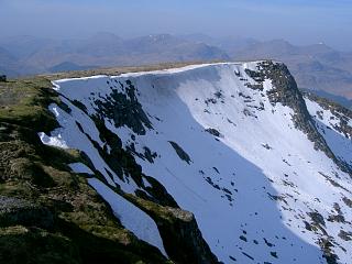
Descend directly NNW from the summit cairn to ridge. This is very steep but the only way to avoid the cliffs to both E and W. (See photo above.) |
700 | NN14374285 | |||
| 1605 | — | Outline of path down Glas Bheinn Chaol ridge N to easy ford of Allt nam Meirleach |
195 | 10.25 miles | NN13824500 | |
| — | OR: (Safer) Continue SW to ridge bend | 845 | NN14204232 | |||
| — | 1500 | WNW to path at Bealachan Lochain Ghain | 765 | NN13914240 | ||
| — | 1525-35 | Path N by Allt nam Meirleach to stream confluence | 540 | |||
| — | 1625 | Path N to fork at ford (easy) | 195 | NN13824500 | ||
| 1635 | THEN: Path N to where it joins B.Starav ridge path | 165 | 10.45 miles | NN13874531 | ||
| 1625 | 1655 | Path N to footbridge over Allt nam Meirleach | 20 | 10.95 miles | NN13614599 | |
| Path NNW on E bank to "ftbr" at track end | 15 | 11.05 miles | NN13524617 | |||
| Hydro track NE passed Coileitir to fork | 25 | 1640 | 11.55 miles | NN14074671 | ||
| Left fork to bridge over R. Etive | 20 | 11.6 miles | NN14044683 | |||
| 1645 | 1725 | Track W back to car | 40 | 1660 | 11.9 miles | NN13714686 |
| Previous | Top | Next |