Previous |
Colin's Munros |
Next |
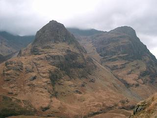
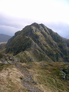
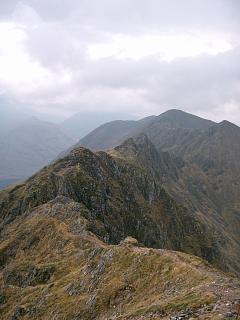
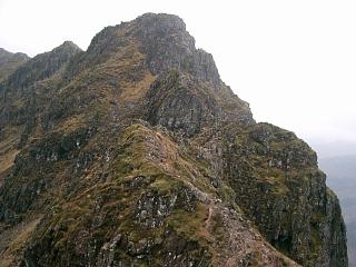
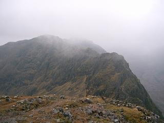
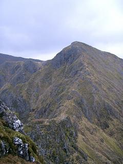
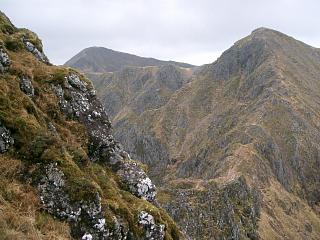
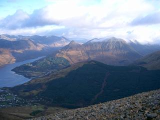
Route:
The ridge is very much easier and more enjoyable in dry conditions.
It involves some straightforward scrambling with intimidating exposure
with much of the rock en route being highly polished and slippery strata sloping downhill.
Both Munros can be climbed separately from the north to avoid any scrambling.
There are some nice winter photos and more detail at
UKClimbing.com.
If you can manage the initial descent westwards from Am Bodach, you can probably manage the
whole ridge. This is not quite the most difficult or exposed part, but it doesn't get much worse.
Almost all difficulties are between Meall Dearg and Stob Coire Leith, which is Aonach Eagach.
The difficulties are a combination of exposure, knife edge ridge with numerous unavoidable pinnacles,
poorly angled, slippery rock with few handholds, and moss.
There are two big detours off the ridge to the north side.
The second is at the W end under the third pinnacle and descends by nearly 30m/100'.
The crux of the whole traverse is at the rather exposed lowest point of this.
Foot and hand holds are neither very plentiful nor good here
and it is not simple to keep one’s centre of balance within points of contact.
However, currently (i.e. June 2019) there is a short, fixed rope to help.
Overall the ridge is technically harder, more exposed, and longer than any other
that you are likely to encounter doing Munros or Munro Tops on mainland Scotland.
This includes, for example, the Torridon ridges.
The short section of about ¾ mile over three pinnacles will take most people
at least an hour in good conditions and an hour and a half or more in poor, non-winter conditions.
Descent via the gully above the Clachaig Inn is possible but dangerous.
An alternative descent is via the col with the Pap (Sgorr na Ciche).
However, my preference is an almost direct line from Sgor nam Fiannaidh to the parking by Loch Achriochtan.
There is a path which initially appears frighteningly steep, but there are no cliffs.
It is very fast and handy with no significant problems other than the
extensive loose scree at its angle of rest. This choice minimises the walk back to the start.
I have the opinion that an east-to-west traverse is easier than the opposite direction
because of the down-climbing involved, but I have not been from west to east.
Moreover, the made-up stepped path at the east end and the scree at the west end
also favour an east-to-west route.
Weather 25/11/04: Overcast but dry till 1400; rain thereafter.
Cloud falling from 1000m to 750m.
11/06/07: Very hot day: 25°C at car, no wind.
Dry, overcast day with sunny intervals, dry underfoot.
Connectivity: Orange on all tops and on road at ends of route.
| 25/11/04 | 11/06/07 | Description | Alt. | Asc. | Dist | Grid Ref |
| 0930 | Park on A82 at P just E of L. Achriochtan (or Park at Helipad on A82 near Meeting of Three Waters) |
90 | 0 | 0.0 miles | NN14645713 | |
| 1000 | 0910 | Walk E to Helipad via path on S side of A82 along old road | 163 | 75 | 1.5 miles | NN16935684 |
| 1005 | 0915 | Reach start of good path up Allt Ruigh at small P on N side of A82 a few yds E of the Helipad |
175 | 85 | 1.75 miles | NN17315677 |
| 1115 -1125 | – | Ascend old route by Allt Ruigh to col NE of Am Bodach or take the new faster path up the SE ridge. |
816 | 725 | NN17205820 | |
| 1140 | 1030 -1035 |
SW (or NW) to T Am Bodach. | 943 | 855 | 2.75 miles | NN16845802 |
| 1045 | Initially tricky descent NW to col. (No further major difficulties until after Meall Dearg.) |
866 | NN16615812 | |||
| 1050 | WNW to cairn on bump | 924 | 840 | 3.1 miles | NN16315821 | |
| 1055 | NW to col | 896 | 3.15 miles | NN16265826 | ||
| 1215 | 1100 -1105 |
NNW to M Meall Dearg The next ¾ mile is the Aonach Eagach ridge. Expect ¾ mph in dry conditions, ½ mph in wet, i.e. up to 1.5 hrs. This section contains almost all the difficulties. |
953 | 970 | 3.25 miles | NN16155837 |
| 1115 | W to 1st pinnacle | |||||
| 1125 | W to 2nd pinnacle | |||||
| 1130 | W to col | |||||
| 1140 | Skirt 3rd pinnacle on right, with substantial down climb. (Optional 5m/5min detour to top when ridge is regained.) |
|||||
| 1155 | W to col | 830 | 3.8 miles | NN15255832 | ||
| 1345 | 1205 -1210 |
NW to T Stob Coire Leith | 940 | 1185 | 4.0 miles | NN14955850 |
| 1215, 1220 |
SW to cols at ends of flat ridge traverse | 870 | 4.4 miles | NN14425825 | ||
| 1410 | 1230 -1235 |
W to M Sgor nam Fiannaidh (trig post) | 967 | 1295 | 4.6 miles | NN14065830 |
| W for 10 yds to top of path. Then descend S down path by Allt an t-Sidhein. Initially there is 500m/1500' of scree. The path meets the A82 by the road to the Clachaig Inn at NN138567 but the corner can be cut off easily. |
5.7 miles | NN14045685 | ||||
| 1535 | 1355 | E along A82 to P just E of L. Achriochtan | 90 | 6.1 miles | NN14645713 |
| Previous | Top | Next |