Previous |
Colin's Munros |
Next |
Route on 23/7/08: This is one of the top ridge walks in Scotland.
Ideally, one should start at the Cairn Gorm car park and finish at Glenmore Lodge
having traversed the whole ridge, as here, and public transport enables this.
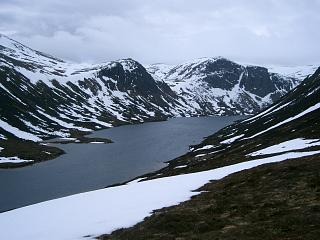
The route provides spectacular views of Loch Avon from The Saddle
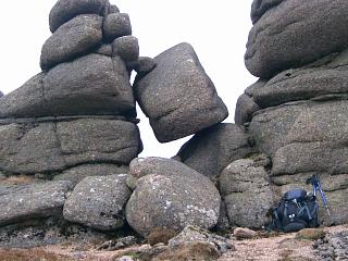
as well as including the Bynack Barns and
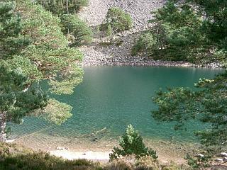
visits the outstandingly beautiful, picturesque and colourful An Lochan Uaine,
before passing through the wonderful Scots pine forest around Glenmore Lodge
and finishing near the sandy shore of Loch Morlich.
Alternatively, one can return from Bynack More via the Saddle and the Ptarmigan Restaurant
back to the starting car park.
Although 2 miles longer, the extra distance to finish at Glenmore Lodge
is along a pleasant, easy track, and 300m/1000' of re-ascent over Cairn Gorm is avoided.
Moreover, there is the opportunity for spotting birds and wildlife on the periphery
of the Abernethy Forest.
If necessary, Bynack More can be omitted with the walk being continued from Cairn Gorm
or Cnap Coire na Spreidhe by a descent northwards either to the start or to Glenmore Lodge
along paths via the Ski Centre or Coire na Ciste.
This would cut the total length to 10.6 miles and the ascent to a mere 910m.
Bynack More can then be climbed separately as here.
Access: Bus 31 running between Aviemore and Choire Chais (Cairn Gorm
car park) can be used to get between the ends of the walk.
One can park by Loch Morlich (by the Ski School/Youth Hostel) at the end of the track
to Glenmore Lodge or in the Cairn Gorm car park, or take the bus from and back to Aviemore.
There is a timetable
here.
Alternatively, in summer a friend may well be happy to drop you at Choire Chais and
spend the day by Loch Morlich awaiting your return.
Route on 27/4/06:
This route has the advantage of returning to the starting point.
Although also being 2 miles shorter, it involves 1000' more ascent.
As with the other route, if conditions dictate
Bynack More can be omitted and done separately from Glenmore Lodge
thereby giving a much shorter circular walk.
This reduces the total length to 9⅓ miles and the ascent to just 890m.
There are also alternative routes up Cairn Lochan which omit Lurchers' Crag,
such as via Fiacaill Coire an t-Sneachda.
Conditions 27/4/06:
The ground is normally still under winter conditions in late April, with ground frozen above 1000m.
Note the danger of avalanches on the direct descent from Cairn Gorm to The Saddle especially after significant rainfall.
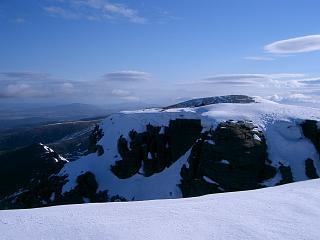
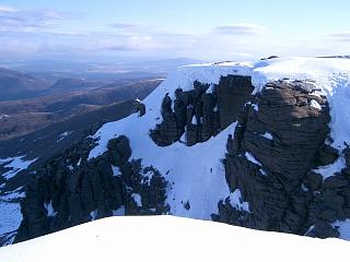
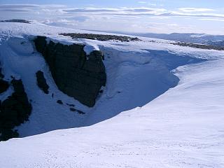
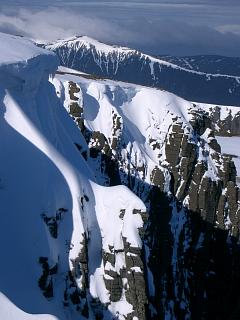
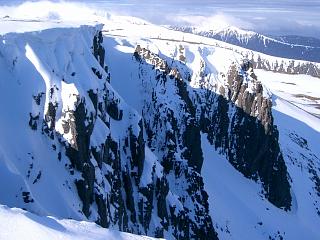
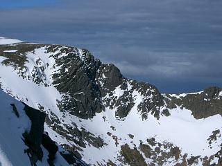
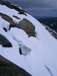
On this occasion the massive snow cornice at the cliffs above The Saddle
exhibited large cracks and was certainly in imminent danger of collapse,
being fully soaked with water. Such an event would have drowned anyone caught in it.
It was necessary to by-pass it with a short detour southwards along the top of the cliffs,
descend to the south of the most dangerous area, and then
cross back hurriedly at the bottom out of the danger zone.
| 27/4/06 | 23/7/08 | Description | Ht. | Asc. | Dist. | Grid Ref. | Mob. |
| 0615 | 0820 | Cairn Gorm Ski Centre, upper car park. (Base station of funicular railway.) |
620 | 0 | 0.0 miles | NH98920610 | Orange |
| ~0845 | Take path SSW from top corner of car park to Allt Coire an Lochain |
760 | 140 | 1.25 miles | NH97930441 | ||
| 0705 | ~0900 | Follow path S a little way up ridge until it becomes a hindrance and easier to walk over the heather. |
950 | 1.8 miles | NH97750357 | ||
| 0915 | Head SSW towards col, to cross stream at 950 (A good source of fresh water) |
950 | 330 | NH97330326 | |||
| 0735 -0745 | 0930 | W to T Creag an Leth-choin | 1053 | 450 | 2.4 miles | NH96880334 | Orange |
| S to col | 997 | NH96980308 | |||||
| 0810 | 0955 | SE to Fiacaill na Leth-choin | 1083 | 540 | 3.12 miles | NH97530242 | |
| E to minor col (at crossing of Ben Macdui path) | 1075 | 3.25 miles | NH97740232 | ||||
| 1010 | E to cairn marking path down ridge | ||||||
| 0845 -0850 | 1020 | E to T Cairn Lochan (Slower speed 27/4/06 as crampons necessary from Fiacaill na Leth-choin to here.) |
1215 | 670 | 3.8 miles | NH98520257 | Orange |
| ENE/E down to col (Slower speed 27/4/06 due to frequent photo stops) |
1111 | NH99180278 | |||||
| 0920 | 1040 | ENE to T Stob Coire an t-Sneachda | 1176 | 835 | 4.55 miles | NH99620298 | Orange |
| NE then N to col | 1099 | NH99950351 | |||||
| 0940 | 1100 | N to Fiacaill a'Choire Chais | 1141 | 875 | 5.25 miles | NH99930399 | Orange |
| ESE to col | 1125 | NJ00120393 | |||||
| 0955 -1005 | 1120 | E to M Cairn Gorm (Note the eye-sore line of designer cairns N to the restaurant.) (From here is possible a return directly to the Ski Centre or Glenmore Lodge.) |
1244 | 995 | 5.67 miles | NJ00580404 | Orange |
| — | EITHER (to include Cnap Coire na Spreidhe): NE to col |
1135 | NJ01000480 | ||||
| — | 1140 | ENE to T Cnap Coire na Spreidhe | 1150 | 1010 | 6.45 miles | NJ01360491 | Orange |
| — | 1145 | S to path in Ciste Mhearad (snow & source of water) | 1070 | NJ01340455 | |||
| — | 1210 | Path SE down to The Saddle
– a good path, but gap of 200m in middle where no clear path. |
807 | 7.5 miles | NJ01830333 | Orange | |
| 1055 | — | OR: Descend SE directly to The Saddle (0.9 miles shorter) (April: Continuous ground snow as far as cliffs at 990m where it was in avalanche condition.) |
807 | 895 | 6.6 miles | NJ01830333 | Orange |
| 1230, 1235 |
THEN: ENE up ridge to two lochans | 910 | 1120 | 8.1 miles | NJ02600393 | ||
| 1140 | 1300 | Along boundary NE/N to T A'Choinneach | 1017 | 1230 | 8.85 miles | NJ03220486 | Orange |
| 1310 | NE to col | 940 | 9.45 miles | NJ03760551 | |||
| 1205 -1225 | 1325 -1330 |
E to ridge & visit Little Barns/Barns of Bynack (0.2 mile detour to Barns) |
1000 | 10.0 miles | NJ04540582 | ||
| 1230 | 1340 | W back to ridge and N to M Bynack More | 1090 | 1380 | 10.45 miles | NJ04200632 | Orange |
| NW to col | 945 | NJ03780666 | |||||
| 1250 | 1355 -1415 |
NW to T Bynack Beg | 970 | 1405 | 10.95 miles | NJ03580688 | Orange |
| SE back to col | 945 | NJ03780666 | |||||
| — | 1430 | EITHER (To finish at Glenmore Lodge): NNE to join path on N ridge |
850 | NJ04080731 | |||
| — | Path N to top 818 | 818 | 12.1 miles | NJ03940807 | |||
| — | 1450 | Path N to path split | 780 | 12.45 miles | NJ03910872 | ||
| — | 1530 | Path NW down to footbridge over R. Nethy.
(This section of constructed path is a joint-killing eye-sore.) |
440 | 14.22 miles | NJ02101050 | ||
| — | 1555 | Track WNW/W to fork at head of pass | 360 | 15.53 miles | NJ00301105 | ||
| — | 1605 -1635 |
Track SSW to picturesque An Lochan Uaine | 15.8 miles | NJ00141075 | |||
| — | Track SW to parking by Glenmore Lodge | 340 | 17.05 miles | NH98740948 | |||
| — | 1710 | Track SW to bus stop at Ski School, Loch Morlich | 330 | 17.8 miles | NH97660976 | ||
| — | OR (To finish at Ski Centre, having previously omitted Cnap Coire na Spreidhe): Contour due S back to col. |
935 | 11.0 miles | NJ03760551 | |||
| 1405 | — | SW back to The Saddle. (I contoured round W of A'Choinneach with much hassle. It's much easier to return over A'Choinneach.) |
807 | 1365 | 12.9 miles | NJ01830333 | Orange |
| 1510 -1515 | — | Ascend NNW diagonally along path (an obvious one from the restaurant) to T Cnap Coire na Spreidhe. |
1150 | 1710 | 13.95 miles | NJ01360491 | Orange |
| — | Due W to just below Ptarmigan Restaurant | 1085 | NJ00450497 | ||||
| 1615 | — | Descend cairned ridge path N/NW/W to Ski Centre | 620 | 15.8 miles | NH98920610 | Orange |
| Previous | Top | Next |